Disclosure: This article contains affiliate links. If you buy through them, we may earn a small commission at no extra cost to you — it helps keep these guides free and independently written.
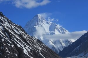
There is a moment on the Baltoro Glacier, somewhere between Goro II and Concordia, when the scale of the place finally breaks through your jet lag, your sore knees, and your carefully researched expectations. The glacier beneath you is a river of ice roughly 62 kilometres long. The walls on either side are not mountains in the way you know mountains — they are granite towers and ice faces stacked thousands of metres above the trail, and at the end of it all, still half a day’s walk away, sits the pyramid of K2. No photograph, and no itinerary table, prepares you for that. But a good itinerary does something almost as valuable: it tells you exactly what each day will ask of you, so that when the scale hits, you are ready for it rather than exhausted by it.
This is the classic K2 base camp trek itinerary — 14 days on the trail, from Askole to Askole, walked by nearly every operator on the route with only small variations. It is the itinerary our K2 base camp packing list and K2 base camp trek cost guide were written to support, so this article does not repeat their ground: permits, prices, and gear live there. What lives here is the shape of the walk itself — how far, how high, and how each day actually feels.
Short Answer
The classic K2 base camp trek is 14 days on the trail: Askole → Jhola → Paiju (plus a rest day) → Khoburtse → Urdukas → Goro II → Concordia → K2 Base Camp and back to Askole by the same route, covering roughly 160 kilometres return. Door to door from Islamabad, allow 20–22 days in total — the 14 trekking days plus flights, the jeep road to Askole, and at least two buffer days, because Skardu flights are weather-dependent and the Baltoro does not care about your schedule. The highest sleeping camp is Concordia at about 4,600 metres; the highest point of the standard trek is K2 Base Camp itself at roughly 5,100–5,150 metres. The Gondogoro La exit is a separate, harder extension, not part of the classic route.
The 14 Days at a Glance
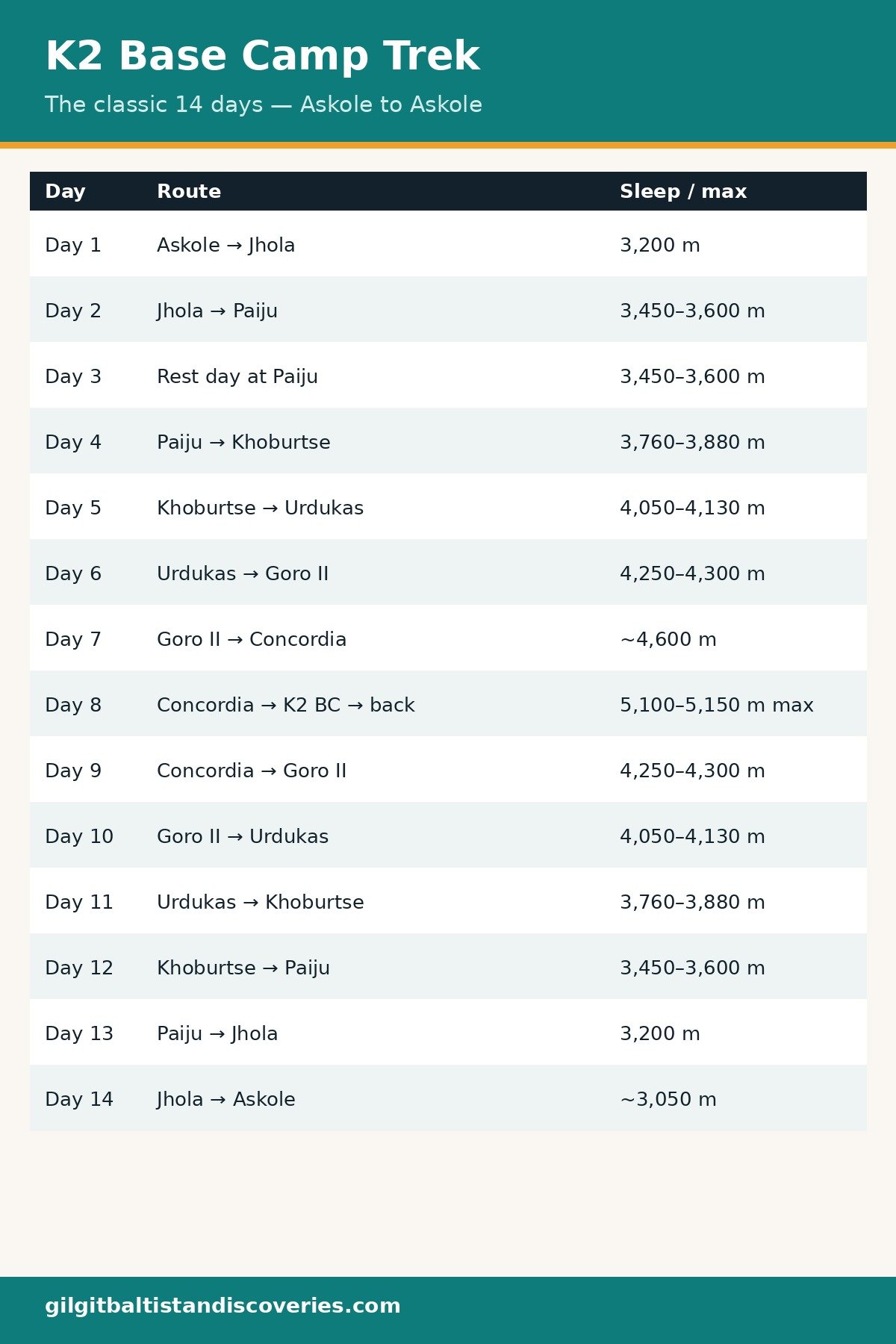
Distances and altitudes on the Baltoro vary between operator tables — the glacier shifts year to year, and camps sit on moving ice and moraine — so the table below gives honest ranges, not false precision. Where sources disagree widely, the range shows it.
| Trek day | Route | Distance | Sleeping altitude | Walking time |
|---|---|---|---|---|
| 1 | Askole → Jhola | 14–20 km | 3,200 m | 5–7 hrs |
| 2 | Jhola → Paiju | 15–21 km | 3,450–3,600 m | 5–8 hrs |
| 3 | Rest day at Paiju (acclimatisation hike) | — | 3,450–3,600 m | 2–3 hrs optional |
| 4 | Paiju → Khoburtse | 14–20 km | 3,760–3,880 m | 6–8 hrs |
| 5 | Khoburtse → Urdukas | 6–10 km | 4,050–4,130 m | 4–5 hrs |
| 6 | Urdukas → Goro II | 12–17 km | 4,250–4,300 m | 5–7 hrs |
| 7 | Goro II → Concordia | 11–12 km | ~4,600 m | 5–7 hrs |
| 8 | Concordia → K2 Base Camp → Concordia | ~11 km each way | 5,100–5,150 m max; sleep ~4,600 m | 8–10 hrs |
| 9 | Concordia → Goro II | ~12 km | 4,250–4,300 m | 5–6 hrs |
| 10 | Goro II → Urdukas | ~17 km | 4,050–4,130 m | 5–6 hrs |
| 11 | Urdukas → Khoburtse | ~10 km | 3,760–3,880 m | 4–5 hrs |
| 12 | Khoburtse → Paiju | 14–20 km | 3,450–3,600 m | 6–7 hrs |
| 13 | Paiju → Jhola | 15–21 km | 3,200 m | 5–7 hrs |
| 14 | Jhola → Askole | 14–20 km | ~3,050 m | 5–7 hrs |
Before the Trail: Getting to Askole
The 14 days above start at Askole, the last permanent village on the route at about 3,000–3,050 metres — but reaching Askole is itself a small expedition, and it is where most itineraries come unstuck. The standard sequence is: arrive in Islamabad, fly to Skardu (about an hour, when the weather allows), spend a day in Skardu sorting permits and supplies, then take a 4×4 jeep to Askole — roughly 180 kilometres of rough mountain road taking 6–8 hours. Some operators build in a night in Shigar on the way; most drive straight through.
Two honest warnings belong here. First, the Islamabad–Skardu flight is famously weather-dependent: whole days of flights can be scrubbed in storms, and there is no cash compensation for a mountain-weather cancellation. This is exactly why the classic trip is 20–22 days door to door rather than 14 — the buffer days are not padding, they are the difference between making your international flight home and missing it. Second, if the flight fails, the overland fallback is a two-day drive via the Karakoram Highway, which is spectacular and not at all a wasted day — but it eats a buffer day whole. Plan for it; hope you don't need it.
Days 1–3: The Valley Approach and the Rest Day That Matters
Day 1, Askole → Jhola (14–20 km, 5–7 hours, sleep 3,200 m). The first day follows the Braldu River out of Askole's poplar trees and terraced fields, crossing the snout of the Biafo Glacier. It is a long, dusty, undulating walk rather than a steep one, and it is deliberately the gentlest introduction: your legs are learning the rhythm, your porters are settling into their loads, and the valley is still green enough to feel familiar. Jhola camp sits beside the river, and the first night under canvas usually comes with a surprise — how loud a glacial river is at 3,200 metres.
Day 2, Jhola → Paiju (15–21 km, 5–8 hours, sleep 3,450–3,600 m). The trail climbs past Bardumal campsite toward the snout of the Baltoro Glacier itself. Late in the day you crest a viewpoint and see the glacier's grey, rubble-covered tongue for the first time — the moment the trek stops being a valley walk and becomes a glacier journey. Paiju is the last camp with anything resembling vegetation, and the last place the air still feels generous.
Day 3, rest day at Paiju. Do not skip this day, and do not let an operator talk you out of it to "save time." The standard itinerary puts a rest day here for a reason: you sleep at roughly 3,500 metres and take a short acclimatisation hike higher — the classic "climb high, sleep low" — before the route commits you to the glacier proper. Trekkers who push straight through Paiju are the ones who tend to struggle at Urdukas and above. Use the day to wash, repair, eat well, and watch the Trango Towers catch the evening light. It is not a lost day; it is the day that buys you the rest of the trek.
Days 4–7: Onto the Glacier, Up to the Throne Room
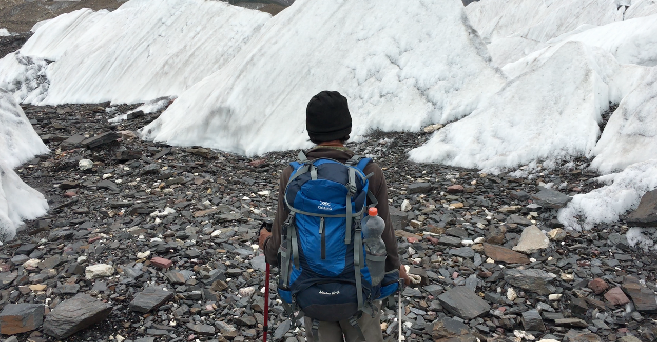
Day 4, Paiju → Khoburtse (14–20 km, 6–8 hours, sleep 3,760–3,880 m). From Paiju the route steps onto the Baltoro's lateral moraine — the long ridge of rock debris along the glacier's edge — and the walking changes character completely. The surface is loose stone and ice, the pace slows, and every step needs attention. Khoburtse is a small, exposed camp; the views back down the glacier are your reward for the hardest footing so far.
Day 5, Khoburtse → Urdukas (6–10 km, 4–5 hours, sleep 4,050–4,130 m). The shortest walking day on the ascent, and deliberately so — the altitude gain is doing the work now. Urdukas is one of the great campsites of the trek: a grassy perch above the glacier with the Trango Towers and Cathedral Spires filling the skyline. Arrive early, rest properly, and take the short evening walk to the viewpoint. This is the camp photographers dream about, and it is also the first night where the cold becomes serious — nights here drop below freezing even in July and August.
Day 6, Urdukas → Goro II (12–17 km, 5–7 hours, sleep 4,250–4,300 m). Now you are camping on the glacier itself, on rough stone and ice, with meltwater as your water supply. The walking is a long moraine traverse with Masherbrum dominating the view ahead. Goro II feels remote in a way nothing before it has — there is no village, no vegetation, no sound except ice and wind. A reliable water filter earns its weight here, since every litre comes from glacier melt.
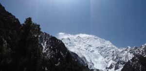
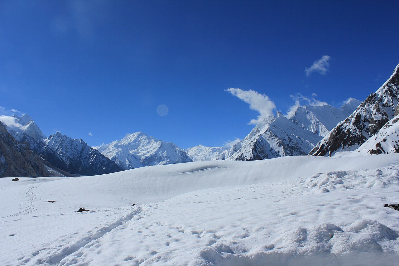
Day 7, Goro II → Concordia (11–12 km, 5–7 hours, sleep ~4,600 m). The approach to Concordia is the emotional centre of the trek. The glacier corridor widens, the peaks stack up on both sides — Gasherbrum IV, Mitre Peak, Muztagh Tower — and then the ice opens into the great amphitheatre where the Baltoro, Godwin-Austen, and Vigne glaciers meet. Concordia, the "Throne Room of the Mountain Gods," is where four 8,000-metre peaks — K2, Broad Peak, Gasherbrum I, and Gasherbrum II — are visible from a single campsite. Walk slowly on this day. You will want to remember it.
Day 8: K2 Base Camp
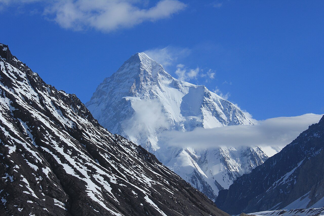
Day 8, Concordia → K2 Base Camp → Concordia (roughly 11 km each way, 8–10 hours, maximum altitude 5,100–5,150 m). The longest and highest day of the standard trek. The route follows the Godwin-Austen Glacier toward the foot of K2's Abruzzi Spur, passing Broad Peak Base Camp on the way — some itineraries camp there to shorten the day, but the classic version returns to Concordia the same evening. The Gilkey Memorial, a stone cairn honouring climbers lost on K2, stands near base camp and is the trek's quiet, sobering moment: this mountain has a history, and standing at its foot puts your own small walk in perspective. Then it is the long walk back to Concordia, arriving tired, sunburnt, and changed. Distances for this day are quoted anywhere from 13 to 22 kilometres return across operator tables, because the route over the ice shifts from season to season — plan on the hours (8–10), not the kilometres.
Days 9–14: The Long Way Down
The return follows the same route, and it is not a formality. Descending the Baltoro takes six days for a reason: the moraine is just as rough downhill, knees take a beating, and altitude still demands respect until you are well below Urdukas.
Day 9, Concordia → Goro II (~12 km, 5–6 hours). The views reverse themselves — peaks you walked toward for a week now fall behind you, and the light on the glacier is entirely different in the morning. Day 10, Goro II → Urdukas (~17 km, 5–6 hours). A long glacier day; this is where well-broken-in trekking boots prove their worth on loose moraine. Day 11, Urdukas → Khoburtse (~10 km, 4–5 hours). Short, and a good place to recover. Day 12, Khoburtse → Paiju (14–20 km, 6–7 hours). Back off the glacier proper and into air that feels thick and generous by comparison. Day 13, Paiju → Jhola (15–21 km, 5–7 hours). The river valley again, and the first green things in a week. Day 14, Jhola → Askole (14–20 km, 5–7 hours). The last walking day ends where the trek began, and the jeep road back to Skardu — usually the same day or the next morning — feels like re-entering civilisation at speed.
How Acclimatisation Works on This Itinerary
The classic itinerary's altitude logic is its quiet genius, and it is worth understanding rather than just following. Sleeping altitudes rise in small steps — roughly 200–500 metres per day above 3,000 metres — with the Paiju rest day breaking the ascent before the glacier proper. The K2 Base Camp day itself is the perfect acclimatisation pattern: climb to 5,100–5,150 metres, then sleep back down at 4,600 metres. No sleeping altitude on the standard route exceeds Concordia's ~4,600 metres, which is why the classic trek, hard as it is, is achievable for fit trekkers without technical climbing experience. The danger is not the maximum altitude — it is rushing: skipping the rest day, or trying to compress the ascent into fewer days, is how altitude sickness takes hold. Walk slowly, drink constantly, sleep low whenever the itinerary allows, and tell your guide immediately about headaches, nausea, or unusual breathlessness. Descending is the treatment, and on this route descending is always possible.
The Gondogoro La Extension (Optional, Not the Default)
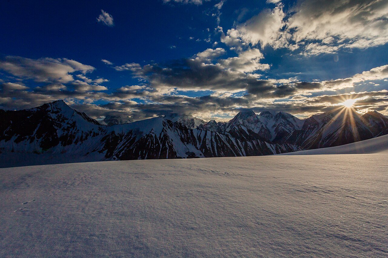
From Concordia, instead of retracing the Baltoro, experienced parties can exit over the Gondogoro La — and this must be understood as a different, harder undertaking, not a scenic bonus day. The extension runs: Concordia → Ali Camp (about 5,000 m, 6 hours up the Vigne Glacier) → a midnight start for the pass itself (5,585 m, 10–12 hours total, fixed ropes on snow slopes up to 50 degrees) → Khuspang (4,600 m) → Saicho (3,300–3,350 m) → Hushe village (3,000–3,050 m) → jeep to Skardu (5–6 hours). It adds roughly four to five days to the trip, requires crampons, harness, and comfort on fixed lines, and is entirely weather-dependent — a bad snow year or a storm can close it outright, and the descent side carries rockfall and avalanche risk that the standard route does not. The reward is real: from the pass, four 8,000-metre peaks stand in a single panorama, and the descent into the green Hushe Valley is one of the great contrasts in trekking. But operators split groups at Concordia for a reason — one party crosses, the other walks back — and if you have no experience above 4,000 metres or no appetite for a 2 a.m. start on a 50-degree snow slope, the classic return is the right choice, not the lesser one. For the pass, mid-July to late August offers the most stable snow conditions; early June can be dangerously icy, and September windows shorten fast.
Where the Itinerary Flexes
No Baltoro itinerary survives contact with the Karakoram unchanged, and the classic version is built to bend in specific places. Skardu flights are the biggest variable — a cancelled flight shifts everything by a day or two, which is why two buffer days are non-negotiable. Weather on the glacier can hold a group at Concordia or Goro II for a day; guides will wait out storms rather than push through them, and you should want them to. River levels on the Braldu can change the first and last days' crossings. Group pace stretches or compresses individual days: strong groups sometimes combine Khoburtse and Urdukas, or walk Concordia to Goro II and beyond — but compressing the ascent is where altitude risk lives, so flexibility belongs on the descent, not the way up. If your operator proposes a 10-day version of this trek, ask exactly which acclimatisation days were removed, and think carefully about the answer.
Fitness and Skill: An Honest Assessment
This is a strenuous trek, and the honest requirement is: multi-day trekking experience, several months of consistent training, and the ability to walk 6–8 hours a day, back to back, on rough ground, while carrying a daypack at altitude. It is not a first trek, and it is not a trek to attempt on enthusiasm alone — the remoteness means there are no tea houses, no roads, and no quick exits between Askole and Concordia. That said, the standard route requires no technical climbing: no ropes, no crampons, no glacier-travel skills are needed on the classic itinerary (the Gondogoro La is the exception). What it requires is fitness, patience, and respect for altitude. Trekkers who arrive with those three things, and with the general northern Pakistan packing system dialled in, finish this trek tired and happy. Trekkers who arrive undertrained finish it injured, or not at all.
When to Go
The season runs June to September. June brings snowier trails and fuller rivers but fewer people; July and August are the classic window, with the most stable weather and the busiest camps; September is quieter and colder, with shorter weather windows and the first snow a real possibility at Concordia. For the Gondogoro La extension specifically, mid-July to late August is the sweet spot. Outside June–September, the route is effectively closed — winter on the Baltoro is an expedition, not a trek.
What This Itinerary Does Not Cover
Deliberately, this article says nothing detailed about permits, prices, or packing — because those already exist, done properly, in the same cluster. For what the trek costs at each tier, read our K2 base camp trek cost guide; for the full gear system, read our K2 base camp packing list. Permits are arranged through a licensed operator in Skardu — do not attempt this trek without one, both for the paperwork and because the Baltoro is no place to be unguided.
Frequently Asked Questions
How many days does the K2 base camp trek take?
Fourteen days on the trail, Askole to Askole, is the classic count. Door to door from Islamabad, allow 20–22 days including flights, the jeep road to Askole, and at least two buffer days for Skardu flight delays and glacier weather.
What is the hardest day of the trek?
Day 8, Concordia to K2 Base Camp and back — 8–10 hours at over 5,000 metres on glacier terrain. The Gondogoro La crossing day is harder still (10–12 hours, technical), but it is an optional extension, not part of the classic route.
Is the Gondogoro La crossing worth it?
If you are fit, acclimatised, and comfortable on fixed ropes, yes — four 8,000-metre peaks from one pass, and a traverse instead of a retrace. If you lack high-altitude experience or the weather is marginal, no: the classic return is the right trek, and the pass will still be there another year.
Can a beginner do the K2 base camp trek?
Honestly, no — not as a first multi-day trek. You need proven multi-day trekking fitness and several months of training. No technical climbing skill is required on the classic route, but the remoteness, altitude, and 6–8 hour days on rough moraine are unforgiving to the underprepared.
What is the best month for the K2 base camp trek?
July and August offer the most stable weather and the fullest camps. June is quieter but snowier; September is quieter and colder with shorter windows. For the Gondogoro La extension, mid-July to late August is best.
Last updated: October 2026