Short Answer
Ishkoman Valley is Ghizer District’s northernmost valley: a long, glacier-fed corridor running north toward Afghanistan’s Wakhan Corridor, visited by far fewer travellers than the valleys south of it. Come for village walks, trout, apricot orchards and the multi-day Karambar Lake trek — not for resorts or a fixed tourist circuit, because there is none. Allow one or two nights for the lower valley around Chatorkhand, and at least five to six days from Gilgit if Karambar Lake is the goal. The upper valley is practically accessible June to September; the lower valley has a slightly longer season.
Where is Ishkoman Valley?
Ishkoman Valley lies in Ghizer District, Gilgit-Baltistan, branching north off the main Ghizer road near Gahkuch and running up the Ishkoman River toward the Wakhan Corridor. The valley runs north to south and separates the Karakoram range from the Hindu Kush. Its main town is Chatorkhand, the headquarters of Ishkoman tehsil, about 80 km north-west of Gilgit city. Beyond Imit, facilities thin out fast, and the valley is one of the most sparsely populated and least developed in the district.
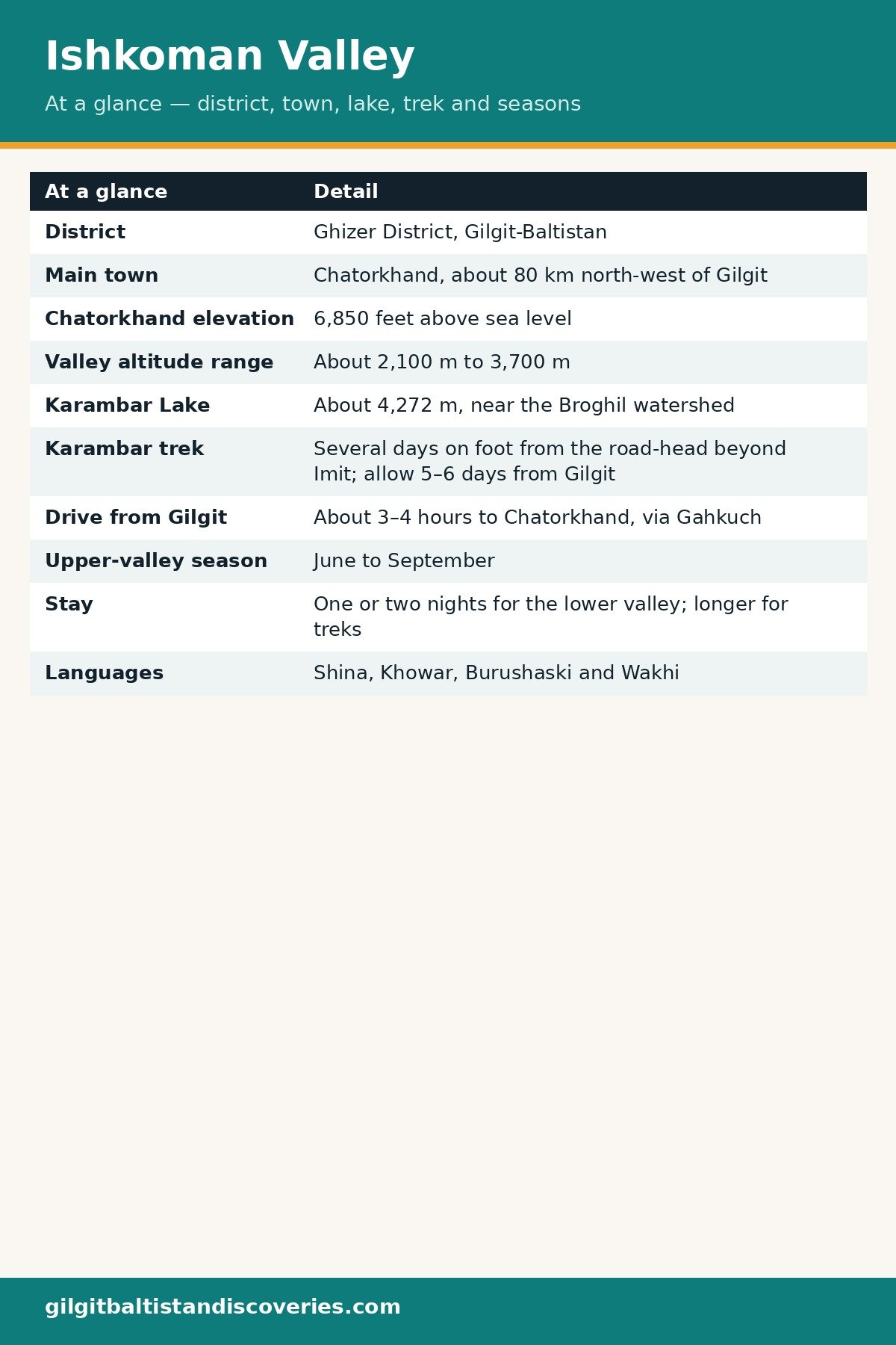
| Ishkoman Valley at a glance | Detail |
|---|---|
| District | Ghizer District, Gilgit-Baltistan |
| Main town | Chatorkhand, about 80 km north-west of Gilgit |
| Chatorkhand elevation | 6,850 feet above sea level |
| Valley altitude range | About 2,100 m to 3,700 m |
| Karambar Lake | About 4,272 m, near the Broghil watershed |
| Karambar trek | Several days on foot from the road-head beyond Imit; allow 5–6 days from Gilgit |
| Drive from Gilgit | About 3–4 hours to Chatorkhand, via Gahkuch |
| Upper-valley season | June to September |
| Stay | One or two nights for the lower valley; longer for treks |
| Languages | Shina, Khowar, Burushaski and Wakhi |
What are the villages along the valley?
Chatorkhand, the valley hub
Chatorkhand is the valley’s main town and administrative hub, where the road from Gahkuch meets the Ishkoman River. It has a small bazaar and teahouses, and it is the last point with reliable shops and fuel, so most travellers overnight here before heading further north. It is also the largest settlement in the valley. Stock up here: cash, snacks, drinking water and anything you forgot in Gilgit, because you will not reliably find them again up-valley.
Imit, Dain and Pakora
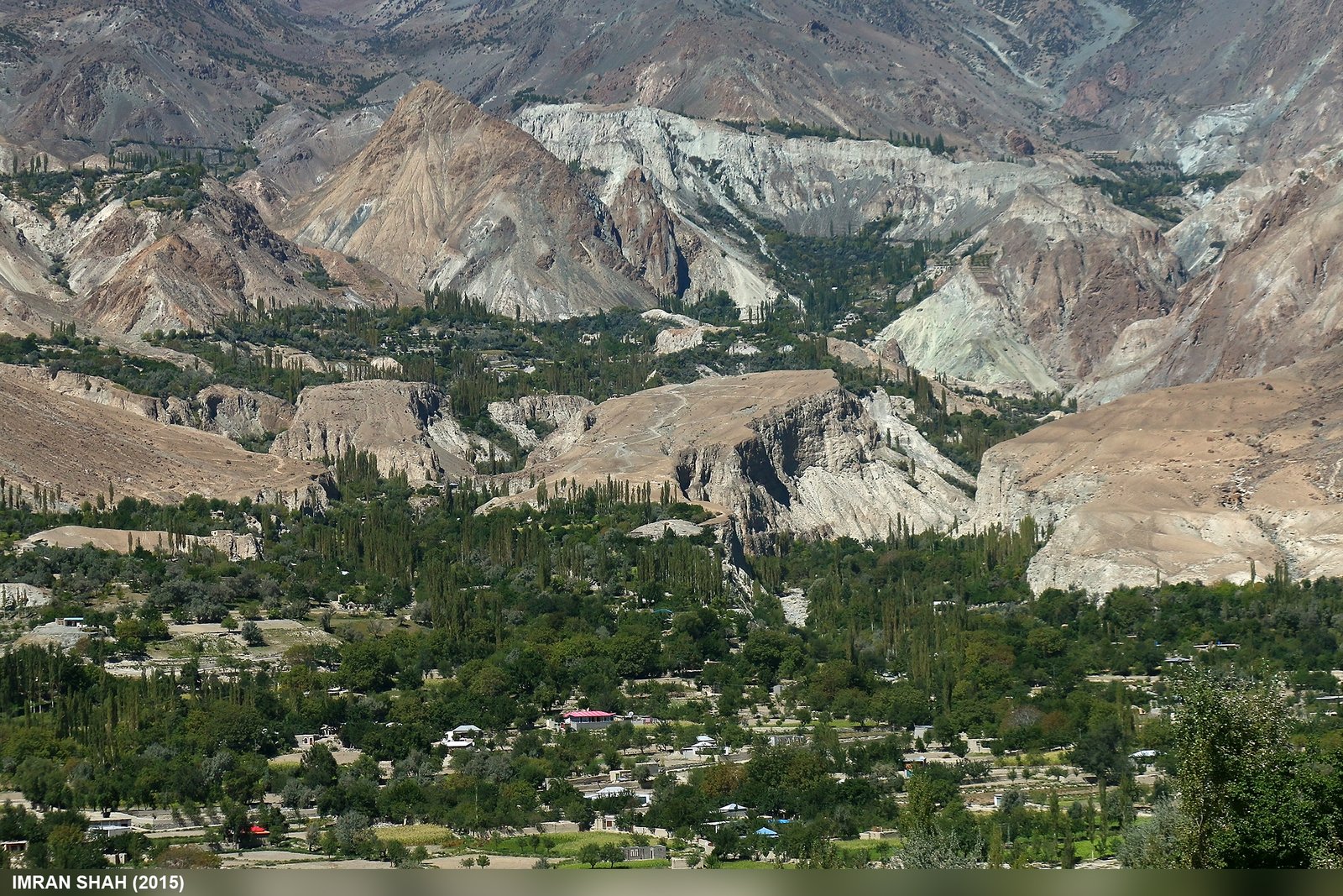
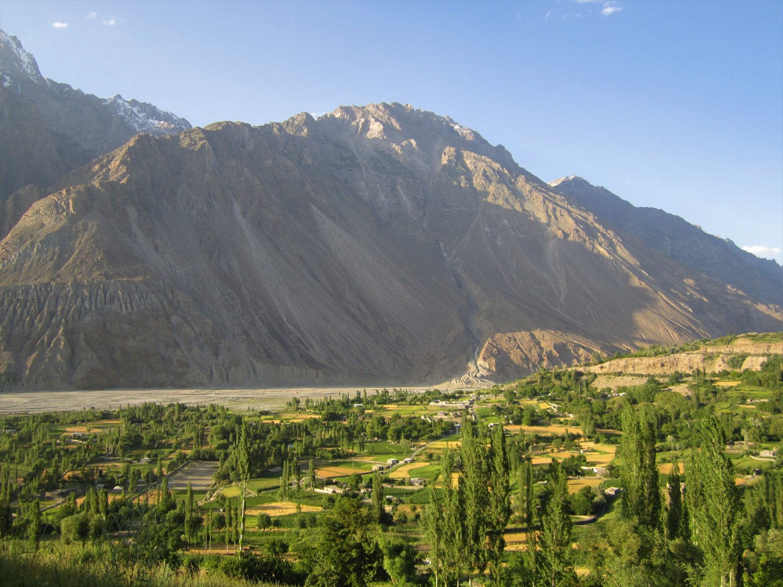
Further up-valley, the road passes villages including Dain and Pakora before reaching Imit, about 25 km from Chatorkhand. Imit sits on the Karambar River side of the valley and is the practical starting point for the Karambar trek and for jeep travel toward the road-head near Matramdan and Bhort. Imit’s apricots are locally prized, and much of the village crop is sold in Gilgit market rather than in Chatorkhand. Facilities thin out noticeably beyond Imit, so treat it as the last planning point, not just another stop.
Birgal and the upper valley
Birgal is a quiet upper-valley village known for its trout farms and mountain scenery — a good base for travellers who want to slow down in Ishkoman rather than pass straight through. Beyond Birgal, the valley becomes herders’ country: high pastures, glacial streams and settlements used in summer, with no fixed tourist infrastructure. That is the appeal, and also the reason a local guide is strongly recommended for anything beyond Imit.
How do you reach Karambar Lake?
The lake itself
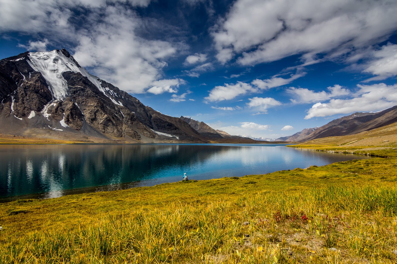
Karambar Lake (also spelled Karumbar) sits at about 4,272 m at the head of the valley, fed by the Karambar Glacier near the Broghil watershed. Sources give slightly different figures — about 4,272 m to 4,275 m — so treat the height as approximately 4,270 m. It is one of the highest large lakes in Pakistan, ringed by peaks above 6,000 m, and it is genuinely remote: no lodges at the lake, no marked tourist trail, and near-zero other visitors.
The trek
Reaching Karambar requires a jeep track from Chatorkhand through Imit to a road-head near Matramdan and Bhort, then several days on foot through the Pakora junction meadows and the herders’ settlements below Ishpishtar. One field guide puts the trek from Imit at 2–3 days and the whole trip at a minimum of 5–6 days from Gilgit; other itineraries allow longer, with acclimatisation and a weather-margin day. Plan on the longer figure, not the shorter one. The area is known for ibex and, at higher elevations, snow leopard tracks — a sighting is luck, not a promise.
The passes out of Ishkoman
Ishkoman is also a pass valley. The Asumbar (Assumber) Pass, about 4,400 m, is a non-glaciated east–west pass linking Ishkoman with the Yasin Valley — the Yasin guide’s second high link between Ghizer’s valleys, in reverse. The Ishkoman Aghost (Panji) Pass, about 4,590 m, also links Ishkoman with Yasin. The Naltar Pass, about 4,600 m, links Ishkoman with Naltar, near Gilgit. All three are multi-day, guide-led routes: ask a local guide which pass is open in your season, and do not attempt them unguided.
What is village life and food like?
A linguistic crossroads
Ishkoman sits at a linguistic and cultural crossroads. Four languages are spoken here — Shina, Khowar, Burushaski and Wakhi — with Wakhi communities, who also inhabit parts of the Wakhan Corridor and Hunza’s Gojal region, living alongside Burushaski and Shina speakers. Village life is closely tied to livestock and high-pasture grazing, and hospitality customs remain strong precisely because so few outside visitors pass through. Travellers are often welcomed into everyday village life rather than a staged event; return the courtesy by asking before photographing people, homes or livestock.
Trout, apricots and pastoral food
Trout is the valley’s best-known specialty, particularly around Birgal, where farms raise fish in cold, clear side-streams and can prepare them freshly cooked for visitors who ask in advance. Ishkoman is also noted for fine apricots, grown in abundance in Pakora, Dain, Chatorkhand and Imit. Beyond fish and fruit, food reflects the pastoral economy: dairy from livestock grazed on the high pastures, hearty flatbread, and dried fruit and nuts carried up from the lower valley for winter. Meals in the remoter villages are simple and seasonal — eat what is offered, and carry your own snacks for trekking days.
Festivals and the seasonal rhythm
Ishkoman’s communities follow the same broad calendar as the rest of Ghizer — Nasalo in winter and spring gatherings around the Chilm Joshi season — alongside the seasonal rhythm of moving livestock up to summer pastures and back. Dates are set locally and are not published as a tourist calendar, so ask in Chatorkhand or Gahkuch a few weeks ahead rather than planning a trip around a festival date found online.
Where to stay and eat
Stays in Ishkoman are village guesthouses, not hotels. Chatorkhand has the valley’s main cluster of guesthouses; further up-valley, options thin out quickly, with Birgal’s guesthouses among the few beyond the main town. Book ahead, since rooms are limited beyond Chatorkhand, and expect a bed, a home-cooked meal and local advice rather than room service. Carry cash from Gilgit: there are no reliable ATMs in Ishkoman, and card payments do not exist here. Food is valley cooking — trout where available, flatbread, dairy, apricots in season — so bring trekking snacks from Gilgit for the Karambar days.
Practical tips for Ishkoman Valley
- One or two nights, longer for Karambar: The lower valley needs a night or two; Karambar Lake needs at least five to six days from Gilgit, including travel, trekking and a weather buffer.
- Guides are essential beyond Imit: The Karambar trek and all three passes are remote, high routes. A local guide is the safety system, the route-finder and the permit check in one.
- Check border-area rules locally: Ishkoman runs toward the Wakhan Corridor, and some high or border areas may need a permit or NOC. Ask in Gilgit or Gahkuch before you go — do not assume the open-valley rule covers the upper valley. The general visa position is set out in the Pakistan Tourist Visa Guide.
- Combine it with Yasin and Phander: Ishkoman, Yasin and Phander are Ghizer neighbours, and the trio makes a natural Ghizer week — Phander’s lake first, then Yasin’s quiet valley, then Ishkoman’s frontier valley (see the companion Yasin Valley guide and Phander Valley guide).
- Pack for a working valley, not a resort: Sturdy boots, layers for 4,000 m-plus passes, sun protection and a water filter cover the valley’s needs. See What to Pack for Northern Pakistan. For the trek, a Sawyer Squeeze water filter and an Anker PowerCore power bank are the two items trekkers most often wish they had packed.
Frequently Asked Questions
Where is Ishkoman Valley?
Ishkoman Valley is in Ghizer District, Gilgit-Baltistan, branching north off the main Ghizer road near Gahkuch and running up the Ishkoman River toward Afghanistan’s Wakhan Corridor. Its main town, Chatorkhand, is the valley’s tehsil headquarters and sits about 80 km north-west of Gilgit city.
What is Karambar Lake?
Karambar Lake is a high-altitude lake at about 4,272 m at the head of Ishkoman Valley, fed by the Karambar Glacier near the Broghil watershed. It is reached by a jeep track beyond Imit and then several days on foot, with a local guide, and has no lodges at the lake.
When is the best time to visit Ishkoman Valley?
June to September for the upper valley and the Karambar Lake trek, when the upper road is practically accessible. The lower valley around Chatorkhand has a slightly longer season, but winter brings snow and closed upper routes, so do not plan Karambar outside summer.
Do I need a guide for Ishkoman Valley?
Village walks around Chatorkhand are possible without a guide, but a local guide is strongly recommended for anything beyond Imit. The Karambar trek and the Asumbar, Ishkoman Aghost and Naltar passes are remote, high routes where a guide provides route-finding, safety and local permit advice.
What languages are spoken in Ishkoman Valley?
Four languages are spoken in Ishkoman Valley: Shina, Khowar, Burushaski and Wakhi. Wakhi communities here share links with the Wakhan Corridor and with Hunza’s Gojal region, while Burushaski and Shina speakers live alongside them in the valley’s villages. Urdu is also widely understood for everyday communication with visitors.
Last updated: 27 October 2026