Last updated: 1 November 2026
Short Answer
For multi-day trekking in Pakistan — the Baltoro to K2 base camp, Gondogoro La, Shimshal, Snow Lake, the high valleys of Hunza and Nagar — buy a satellite communicator that runs on the Iridium network, sends two-way text messages, and has a dedicated SOS button monitored around the clock. The default choice is the Garmin inReach Mini 2: 100 g, up to 14 days of battery at 10-minute tracking, and a screen and buttons that work without a phone. The budget alternative is the ZOLEO (150 g, 200+ hours of battery), which is cheaper to buy but does almost everything through a paired phone. Either way, the device is only half the purchase: it needs an active satellite subscription to send anything at all, including SOS, so budget for the monthly plan, not just the hardware. And check the rules before you travel — Garmin itself notes that some jurisdictions regulate or prohibit satellite communication devices, and Pakistan’s telecom rules for such devices were not verifiable at the time of writing (see “What about the rules in Pakistan?” below).

Where does mobile signal actually end in Gilgit-Baltistan?
Gilgit-Baltistan’s regional operator is SCOM (Special Communications Organization), and it is the network that reaches furthest into the mountains. Pakistan’s telecom regulator, the PTA, found in its Q2 2026 quality survey that SCOM led the major quality categories across surveyed areas of Azad Jammu and Kashmir and Gilgit-Baltistan, including in Astore, Gorkot and Rattu in Gilgit-Baltistan. SCOM is generally strongest in towns — Gilgit city, Karimabad in Hunza, Skardu city — and is usually the most reliable option in Upper Hunza and Ghizer where national networks fail.
But “strongest” is not “everywhere”. The honest picture, from the coverage picture described by northern-Pakistan connectivity guides, is:
| Place | Mobile signal reality |
|---|---|
| Gilgit city, Karimabad (Hunza), Skardu city | Strong 4G on SCOM and national networks |
| Karakoram Highway | Patchy — good in towns, drops in deep gorges |
| Upper Hunza (Passu, Gulmit), Ghizer | SCOM most reliable; other networks moderate to absent |
| Khunjerab Pass (4,693 m) | No mobile coverage |
| Deosai National Park | Virtually no coverage, limited SCOM at the edges |
| Shimshal and other remote valleys | Very limited to none — satellite communication advised |
| Baltoro Glacier, Concordia, K2 base camp | No mobile coverage for days at a time |
The rule of thumb: once you leave the last road-head town and start a multi-day trek, assume your phone is a camera and a map, not a telephone. That is the gap a satellite communicator fills — it talks to satellites, not to cell towers, so it works wherever it can see open sky.
How does a satellite communicator actually work?
A satellite communicator is not a satellite phone and not a broadband terminal. It sends short text messages, your GPS location, and an SOS alert through a satellite constellation — in practice, Iridium, a constellation of 66 cross-linked low-Earth-orbit satellites that covers the entire surface of the Earth, including the poles. A message goes from your device to the nearest satellite, is relayed to a ground station, and on to the recipient’s phone or email, usually within minutes when the device has a clear view of the sky.
That “clear view of the sky” is the key limitation. Satellite communicators need open sky. Deep gorges, dense forest canopy and being inside a tent or building all slow or block messages. Garmin’s own battery figures for the inReach Mini 2 make the point: up to 14 days at 10-minute tracking with a full sky view, but only up to 4 days with moderate tree cover. On a Karakoram trek you mostly have open sky — glacier valleys are wide — but in a narrow gorge section, expect delays, and do not stand under a cliff waiting for a message to send.
What a communicator does, in order of importance:
- SOS — a dedicated, covered button that sends your GPS coordinates to a 24/7 emergency response coordination centre and opens two-way text communication with rescuers.
- Check-ins — preset “I’m OK” messages with your location, sent to chosen contacts at no extra message cost on most plans.
- Two-way texting — short messages to any phone number or email address, so you can report a delay, change a pickup, or describe an injury in words rather than a single distress signal.
- Tracking — automatic location points at intervals you choose, so family or your operator can follow your progress on a map.
- Weather forecasts — a requested forecast for your location or a waypoint, which matters when a pass day depends on the next morning’s conditions.
Note what it does not do: it does not make voice calls, and it does not give you internet. Messages are short — 160 characters per text on Garmin’s standard setup, up to 900 characters on ZOLEO’s app. You are writing telegrams, not emails.

Which device should I buy? The two real options
| Feature | Garmin inReach Mini 2 | ZOLEO |
|---|---|---|
| Satellite network | Iridium, global | Iridium, global |
| Weight | 100 g (3.5 oz) | 150 g (5.3 oz) |
| Size | 5.17 × 9.90 × 2.61 cm | 9.1 × 6.6 × 2.7 cm |
| Battery | Up to 14 days (10-minute tracking, clear sky); up to 30 days (30-minute tracking) | 200+ hours (checking messages every 12 minutes) |
| Works without a phone? | Yes — screen, buttons, on-device messaging, waypoints, TracBack routing, digital compass | Only SOS and check-in; two-way messaging needs the paired phone app |
| Water resistance | IPX7 (submersible to 1 m for 30 minutes) | IP68 (submersible to 1.5 m for 30 minutes) |
| SOS monitoring | Garmin Response, 24/7 | 24/7 emergency response coordination partner |
| GPS accuracy | GPS, Galileo, QZSS | GPS, GLONASS, 2.5 m under ideal conditions |
| Device price (reported, check at purchase) | Around US $400 | Around US $200 |
Buy the inReach Mini 2 if you want the device to work on its own. On a glacier trek, phones run out of battery, get dropped, and die in the cold; a communicator with its own screen and buttons keeps working after the phone gives up. Its navigation features — waypoints, TracBack routing back along your track, a digital compass — are a genuine bonus on featureless glacier moraine.
Buy the ZOLEO if budget matters most and you are confident your phone will survive the trek. It is roughly half the price of the Mini 2, its battery lasts 200+ hours, and its app gives you longer messages (up to 900 characters) plus a dedicated SMS number and email address so family can message you directly. Its weakness is structural: without a working phone, you can send SOS and a check-in, but not a two-way message explaining what is wrong.
A third name you will see is the SPOT X, a keyboard-equipped messenger on the Globalstar network rather than Iridium, with a basic plan reported at US $24.99 a month and a device price around US $250. It is a legitimate option, but Iridium’s genuinely global coverage — including the high latitudes and the Karakoram — is the safer bet for Pakistan’s mountains, and independent testing has reported the SPOT X struggling to acquire satellites in overcast conditions where the Mini 2 kept working. For a Pakistan trek, choose Iridium.
What does the subscription actually cost?
This is where most buyers get caught out. The device price is a one-off; the subscription is the real cost, and without an active plan the device sends nothing — no messages, no tracking, and no SOS.
Garmin reorganised its consumer plans in 2025, so older reviews show different names (Safety, Recreation, Expedition). The current consumer tiers, as reported in 2025–2026 plan guides, are:
| Plan | Monthly price (reported) | What you get |
|---|---|---|
| Essential | US $14.99 | SOS, 50 text/weather messages, 10 photo or voice messages |
| Standard | US $29.99 | SOS, 150 text/weather messages, unlimited tracking and check-ins, 25 photo or voice messages |
| Premium | US $49.99 | SOS, unlimited texts, live tracking to 2-minute intervals, 50 photo or voice messages |
There is also a low-cost “Enabled” option reported at US $7.99 a month, offering SOS with other services charged per use (about US $0.50 per message) — a sensible choice if you trek once a year and want SOS cover without a full plan. An activation fee of around US $39.99 is reported for new accounts, and plans can generally be suspended between trips, though a suspended device cannot send SOS.
ZOLEO’s plans start at a reported US $20 a month for its basic plan (25 satellite messages, unlimited SOS and check-ins), with additional messages around US $0.65 each, and suspension possible after the first 3 months.
Two honest warnings on price. First, every figure above is a reported price that changes — check Garmin’s and ZOLEO’s current plan pages before you buy, and work out the two-year cost (device plus subscription), not just the headline device price. Second, a satellite subscription does not pay for rescue itself: it pays for the message that summons rescue. Helicopter evacuation in the Karakoram is a separate, large cost, which is why trekking insurance with high-altitude evacuation cover matters — see our altitude and packing guides linked below.
What about the rules in Pakistan?
This could not be fully verified, and you should check before travelling. What is established: Garmin’s own product pages warn that some jurisdictions regulate or prohibit satellite communication devices. Pakistan’s telecom regulator, the PTA, requires telecom equipment to be PTA-approved, and it operates a device registration system (DIRBS) under which international travellers bringing phones into Pakistan must register devices and settle Federal Board of Revenue taxes for stays beyond 120 days, with a temporary registration option for short stays. Whether a personal satellite messenger such as an inReach or ZOLEO needs separate permission in Pakistan, and how that permission is obtained, was not confirmed from an official source at the time of writing — the PTA material found concerned in-flight satellite services and phone registration, not personal satellite messengers.
Practical advice, not legal advice: carry the device in hand luggage, keep its purchase receipt and your subscription details, tell your trekking operator in advance that you are bringing it, and ask them — a Gilgit-Baltistan local operator deals with this question regularly — whether any declaration is needed on arrival. Do not assume that because a device is sold freely in the US, UK or EU, it is automatically unrestricted everywhere. If your operator advises against bringing it, listen: a local operator’s advice on the current ground reality outweighs any guide.
How do I use one well on a Karakoram trek?
- Test it before you leave home. Activate the subscription, pair the app, send test messages, and trigger a test check-in. Do not let the first use be on the Baltoro.
- Register emergency contacts properly. Your SOS goes to a coordination centre, but your check-ins and tracking go to the people you nominate. Give them your itinerary, your operator’s phone number, and the dates you expect to be out of contact.
- Carry it on your person, not in your pack. Clip it to a shoulder strap or chest pocket. If you fall into a crevasse or are separated from your pack, the device in the pack is useless.
- Keep it charged and warm. Cold kills batteries. Keep the device inside your jacket in camp, and carry a power bank — the Anker PowerCore on Amazon is the pre-verified power bank in our packing guides. Recharge the communicator at camp each evening rather than waiting for a low-battery warning.
- Send a check-in every evening. A daily “OK at camp X” message does two things: it reassures home, and it creates a trail of last-known positions if something goes wrong the next day.
- Know what SOS does and does not do. SOS summons help; it does not guarantee a helicopter in bad weather. In a storm, rescue may wait a day or more. Your first response to trouble is still your own judgement, your guide, and your group — the device is the backup, not the plan.
- Use tracking sparingly. 10-minute tracking drains battery fastest. On a 14-day K2 base camp trek, 30-minute intervals or manual check-ins will comfortably outlast the trek; save the frequent tracking for a genuine concern.
What should I actually buy? A decision checklist
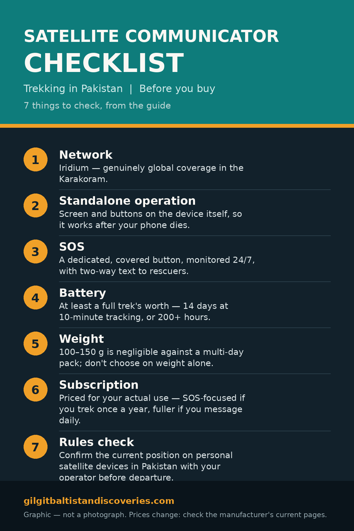
- Network: Iridium, for genuinely global coverage in the Karakoram.
- Standalone operation: a screen and buttons on the device itself, so it works after your phone dies — this is the Mini 2’s decisive advantage.
- SOS: a dedicated, covered button, monitored 24/7, with two-way text to rescuers.
- Battery: at least a full trek’s worth — 14 days at 10-minute tracking (Mini 2) or 200+ hours (ZOLEO) both clear a 14-day K2 base camp trek with sensible use.
- Weight: 100–150 g is negligible against a multi-day pack; do not choose on weight alone.
- Subscription: priced for your actual use — an SOS-focused plan if you trek once a year, a fuller plan if you want daily family messaging.
- Rules check: confirm the current position on personal satellite devices in Pakistan with your operator before departure (see above — unverified at time of writing).
No price is quoted as current in this guide, because device and plan prices change: check the manufacturer’s current pages, and judge every option against the checklist above, not against its marketing headline. For comparing current options, use a tagged search — satellite communicators on Amazon.
Related guides
See also: K2 Base Camp Trek Packing List, What to Pack for Northern Pakistan, SIM Card, Cash and ATMs in Gilgit-Baltistan, and Altitude Sickness in Gilgit-Baltistan.
Frequently Asked Questions
Do I need a satellite communicator for trekking in Pakistan?
Yes, for any multi-day trek beyond the road-head. Mobile signal ends at the last town on most Karakoram routes — there is no coverage at Khunjerab Pass, in Deosai, on the Baltoro Glacier or in Shimshal — so a satellite communicator is the only way to call for help or reassure family for days at a time.
Which satellite communicator is best for the Karakoram?
The Garmin inReach Mini 2 is the default choice: 100 g, Iridium global coverage, two-way messaging and SOS on the device itself, and up to 14 days of battery at 10-minute tracking. The ZOLEO is the budget alternative at roughly half the device price, but it needs a paired phone for two-way messaging.
Does a satellite communicator work without a subscription?
No. Every satellite communicator needs an active plan to send anything, including SOS. Garmin’s plans start at a reported US $14.99 a month, ZOLEO’s at US $20 a month, and both can usually be suspended between trips — but a suspended device cannot send SOS, so never suspend it mid-trek.
Will my satellite communicator work on the Baltoro Glacier?
Yes, provided it has a clear view of the sky. Iridium covers the entire Earth, and glacier valleys are mostly open sky, so messages normally go through within minutes. Expect delays in deep gorges or under heavy cloud, and keep the device on your person rather than buried in your pack.
Is it legal to bring a satellite communicator into Pakistan?
This could not be fully verified from an official source at the time of writing. Garmin warns that some jurisdictions regulate satellite devices, and Pakistan’s PTA requires telecom equipment approval and operates a device registration system for travellers’ phones. Ask your Gilgit-Baltistan trekking operator before departure whether any declaration is needed, and carry your purchase receipt.