Short Answer
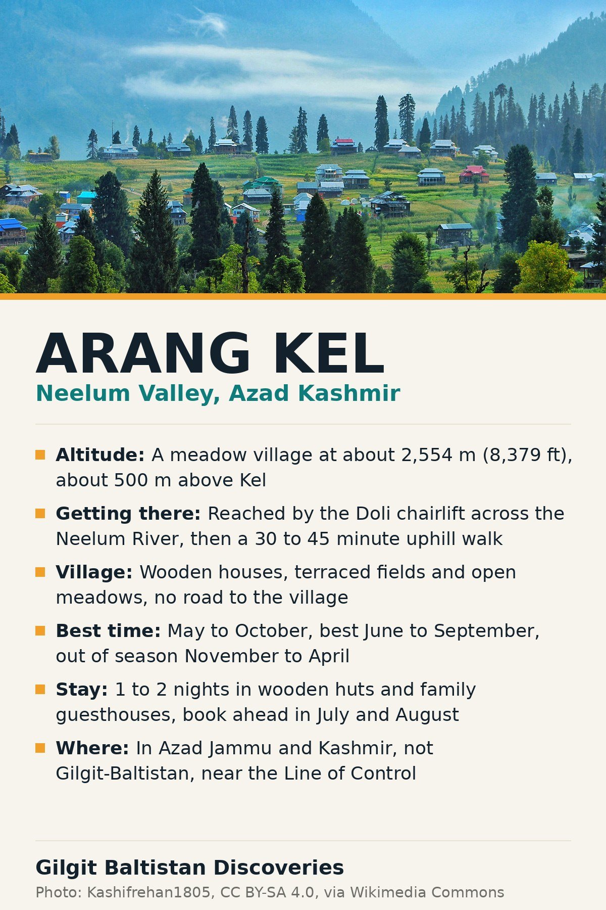
Arang Kel is a small meadow village on a green shelf about 500 m above Kel in upper Neelum Valley, Azad Jammu and Kashmir, at about 2,554 m (8,379 ft). There is no road to the village. You reach it from Kel by the chairlift, locally called the Doli, across the Neelum River, then a steep uphill walk of 30 to 45 minutes through pine forest. The village is wooden houses, terraced fields and open meadows, with wide views over the Neelum gorge.
Arang Kel is out of season right now. It is mid-November, and the upper valley is heading into its winter closure. The visitable window is May to October, with June to September the best months. Plan for one or two nights on the meadow. Arang Kel is in Azad Kashmir, not in Gilgit-Baltistan. Our Neelum Valley travel guide covers the whole valley; this guide covers Arang Kel village itself in depth.
Arang Kel at a glance
| Fact | Detail |
|---|---|
| Location | Across the Neelum River from Kel, Neelum Valley, Azad Jammu and Kashmir |
| Altitude | About 2,554 m (8,379 ft) |
| Above Kel | About 500 m up, about 2 km away |
| How to reach | Chairlift (Doli) from Kel, then a 30 to 45 minute uphill walk |
| Best time | May to October, best June to September |
| Winter | November to April, snowbound, most guesthouses closed |
| Where to stay | Wooden huts and family-run guesthouses, 1 to 2 nights |
| Nearest town | Kel, about 155 km from Muzaffarabad |
| Mobile signal | Effectively absent in the village |
Where is Arang Kel and what is the village like?
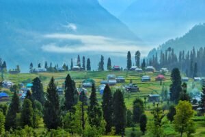
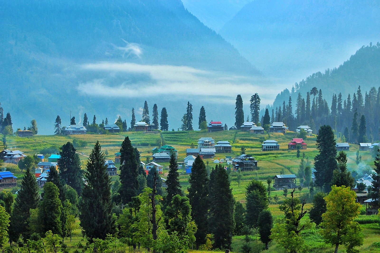
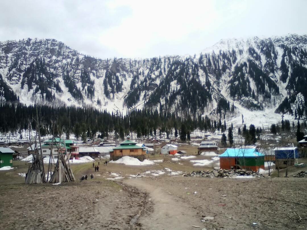
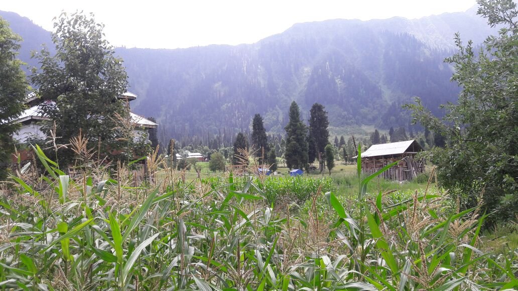
Arang Kel sits on a plateau high above Kel, on the far side of the Neelum River in the upper Neelum Valley. It is often called the Pearl of Neelum Valley, and the nickname fits: a spread of wooden Kashmiri houses, terraced fields, walnut trees and open green meadows, ringed by pine forest, with the river gorge far below.
The village is small and quiet. There are no shops of any size, no road, and almost no mobile signal. What you come for is the setting itself: slow mornings in the mist, the meadows in summer green, and the wide views down the valley. On a clear day, travellers report that Nanga Parbat is visible from the meadows, though that depends on the weather and we could not verify it from a second source.
Life here is simple and local. The houses are built of timber in the traditional Kashmiri style, the fields are worked by hand, and the guesthouses are run by village families. That is the whole appeal. Arang Kel is not a resort with activities on tap. It is a place to walk, sit, watch the light change over the gorge, and sleep early.
When is the best time to visit Arang Kel?
The short answer is June to September. The wider window is May to October, and every month inside it feels different.
| Months | What to expect |
|---|---|
| May | The valley reopens after winter, rivers full with snowmelt, meadows turning green, confirm the road and the lift first |
| June to September | The best window, green meadows, summer days about 15C to 25C, cold nights, wildflowers in the meadows |
| October | Autumn colours, golden poplars and chinar, fewer people, colder nights, confirm the lift is still running |
| November to April | Out of season, the upper valley beyond Keran is often snow-blocked and most high guesthouses close |
If you are reading this in November, do not plan a trip for this month. The meadow is snowbound in winter, with temperatures often below minus 5C, and the chairlift does not run reliably in heavy snow. The exact opening and closing dates shift every year with snowfall, so even in May or October, confirm locally before you travel.
How do you get to Arang Kel?
Arang Kel is reached in stages, and the last stage is the memorable one. There is no direct route from Islamabad, and Kel itself takes most of a day to reach.
| Leg | Distance | Time |
|---|---|---|
| Islamabad to Muzaffarabad | About 130 km | 3 to 4 hours |
| Muzaffarabad to Kel | About 155 km | Roughly 6 to 8 hours |
| Sharda to Kel | About 19 km | Short but slow, rough road, 4×4 better |
| Kel to Arang Kel | About 2 km, 500 m up | Chairlift a few minutes, then a 30 to 45 minute walk |
Drive from Islamabad to Muzaffarabad, then follow the Neelum Valley Road upstream through Keran and Sharda to Kel. The road is paved up to Sharda. Beyond Sharda it turns narrow and rough, so a 4×4 is the better choice, and most itineraries build in an overnight at Keran or Sharda rather than pushing straight through to Kel in one day.
From Kel, you cross the Neelum River by the chairlift, then walk uphill to the village. There is also a longer walking route from Kel that crosses the river by bridge and climbs the whole way, taking about 1.5 to 2.5 hours. Our Neelum Valley travel guide covers the valley road and the stops on the way up in full.
What is the Arang Kel chairlift like?
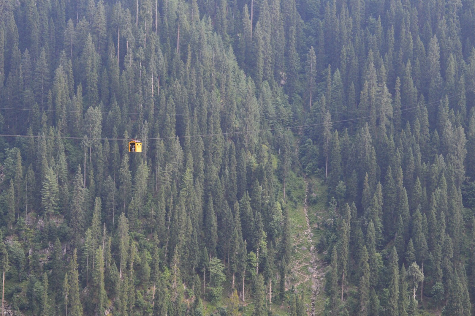
The chairlift, locally called the Doli, is a small open chairlift that carries two to three people at a time across the Neelum River from Kel. It is monitored by the army, and the ride itself takes only a few minutes, but the views are the point: the river below, the pine forest, and the meadows above.
A few practical points. The lift runs weather permitting, and it may not run in heavy rain, strong wind or snow. On peak summer weekends the queues can be long, so arrive early in the morning. Confirm the last return ride before you go up, so you are not caught on the wrong side of the river at the end of the day. We could not verify a current fare from two reliable sources, as published reports range widely, so confirm the fare locally in Kel before you ride.
How long is the hike from Kel to Arang Kel?
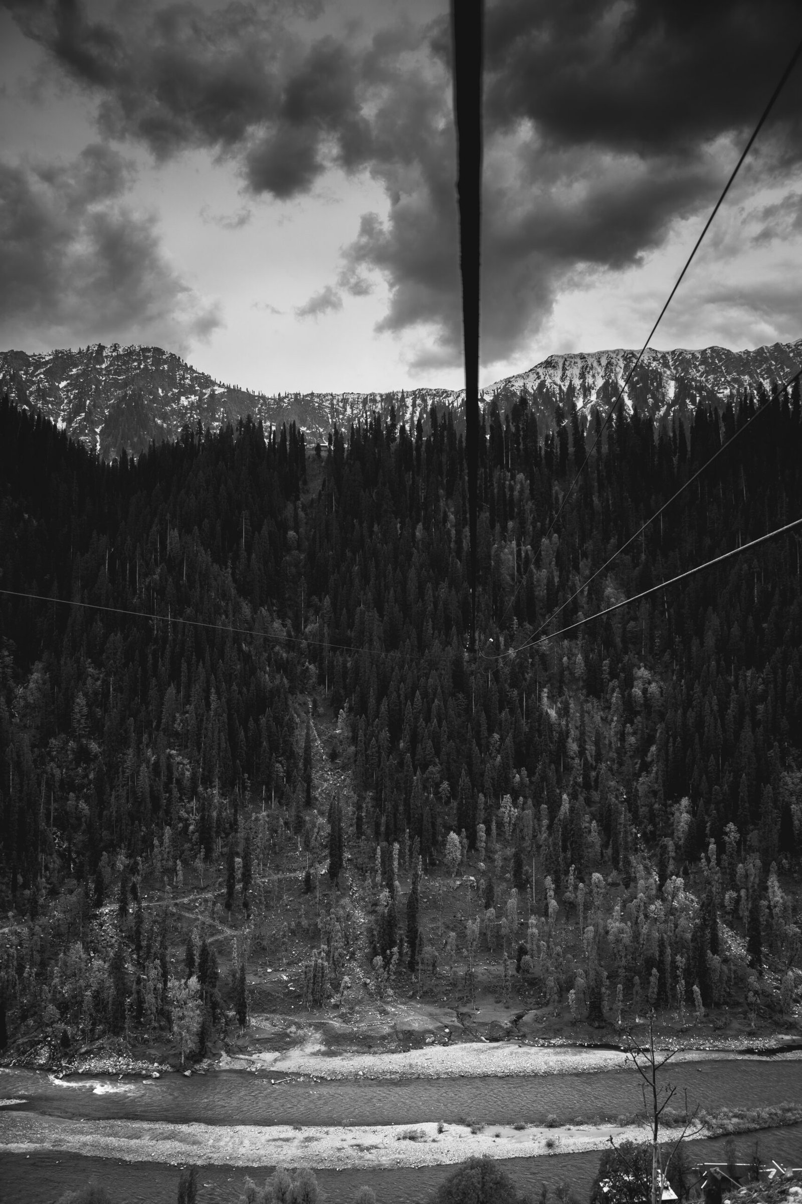
After the chairlift, the walk to the village takes 30 to 45 minutes uphill on a steep path through pine forest and open meadow. It is moderately challenging, and the path gets muddy and slippery after rain, so wear shoes with grip and take your time.
If you skip the chairlift and walk the whole way from Kel, allow about 1.5 to 2.5 hours, depending on your fitness. Some sources describe a longer bridge route of three to four hours, so the time depends on which path you take. Either way, this is a proper uphill walk, not a stroll. Start early, carry water, and do not plan to arrive after dark.
Where can you stay in Arang Kel?
You stay in wooden huts and small family-run guesthouses on the meadow, including Wanderlust Chapter 1 and Chapter 2, the two established resorts at Arang Kel, both meadow-facing with in-house dining. Tented camps also operate in summer.
Standards are basic, and that is the trade for waking up on the meadow. Expect shared bathrooms in some places, generator power for a few hours only, and blankets rather than heating. Nights are cold even in July at this altitude, so pack thermal layers.
Capacity is genuinely small, so July and August weekends need booking ahead. We could not verify any current guesthouse prices from reliable sources, so confirm rates locally or through your guesthouse before you travel. If Arang Kel is full, Kel below has a wider range of guesthouses and works as a base, though you lose the sunrise on the meadow. This section has no photo by design: no licence-verified photo of an Arang Kel guesthouse was found on Wikimedia Commons.
What can you do in Arang Kel?
The sunrise over the meadows is the reason most people come, so stay a night if you can. Walk the meadows and the terraced fields, sit at the meadow edge above the Neelum gorge, and watch the light change over the valley in the evening.
On a second day, walk further up towards the higher pastures above the village. The paths are unmarked, so ask your guesthouse host which way to go and how far is sensible. Photography is best in the early morning, when mist sits in the valley below, and at sunset, when the meadows turn gold.
Evenings are quiet. There is almost no mobile signal and only a few hours of generator power, so bring a book and expect an early night. The stars are bright on clear nights at this altitude.
How many days should you spend in Arang Kel?
One night on the meadow is enough to see the village, watch the sunrise, and walk the nearby pastures. Two nights is better if you want a slow second day and a walk to the higher pastures without rushing.
Reaching Kel itself takes most of a day from Islamabad, so allow five to six days from Islamabad for a comfortable Neelum Valley trip: a day for the lower valley, a day for Sharda and Kel, a day or two for Arang Kel, and a day for the return. Our Neelum Valley travel guide sets out a four-day valley itinerary that fits Arang Kel into a wider trip.
What should you pack for Arang Kel?
Pack for a cold mountain night even in summer, and for a village with almost no electricity and no mobile signal.
- Warm layers and a thermal top, nights are cold even in July at 2,554 m
- Sturdy walking shoes with grip, the path is steep and slippery after rain
- A rain jacket, mountain weather turns fast
- A power bank, power is generator only for a few hours. A reliable option is the Anker PowerCore 10000mAh, small enough to keep in a jacket pocket
- Sun protection, the meadow sun is strong at altitude
- Enough cash, card payment is not something to count on in a village with generator power and almost no signal
- A water bottle and a small daypack for the walk up from the chairlift
- Tell people at home you will be out of contact for a day or two
Disclosure: as an Amazon Associate, we earn from qualifying purchases made through links on this page.
How much does a trip to Arang Kel cost?
There is no reliable published price list for Arang Kel, so this guide gives no fixed prices. The chairlift fare, guesthouse rates and jeep fares all vary by season and by who you ask, and the figures published online conflict with each other. Confirm each cost locally in Kel, or through your guesthouse or driver, before you travel.
What we can say is that Arang Kel is a budget destination by nature. The stays are simple family guesthouses and wooden huts, the food is home cooked, and the main costs are transport to Kel and the night on the meadow. Shared jeeps run from Muzaffarabad to Kel, and hiring a 4×4 with a local driver for the upper valley is the usual choice beyond Sharda.
Is Arang Kel safe to visit?
Neelum Valley runs along the Line of Control, and Arang Kel sits in the upper valley near it. When the situation is calm, the valley draws large numbers of domestic visitors each summer. Access can change at short notice, though: in May 2025, during India-Pakistan tensions, authorities temporarily stopped tourists entering the valley, and in June 2026 the AJK government issued an advisory asking visitors to leave during a protest strike.
Stay on the main road and in the main villages, follow local guidance on photography and movement near the river, and do not cross barriers. Check current advisories and AJK government and district administration guidance before travelling, and ask your guesthouse host about conditions on the day. Foreign nationals need the Neelum Valley permit that applies to the rest of the valley.
Can you combine Arang Kel with Naran and Babusar Pass?
Yes, in summer. Some travellers combine Neelum Valley with Naran and Kaghan Valley by crossing Babusar Pass, which links Kaghan Valley to Gilgit-Baltistan in the summer months. That combination only works when the pass is open. Babusar Pass closed on 11 October 2026, with reopening expected about June 2027, so check our Babusar Pass guide for the current status before you plan around it. In winter, both the pass and the upper Neelum Valley are shut, so the combination is a summer plan only.
Frequently Asked Questions
No. Arang Kel is out of season from November to April. The upper Neelum Valley beyond Keran is often snow-blocked in these months, the chairlift does not run reliably, and most guesthouses in the village close. Plan your visit between May and October instead, with June to September the best window.
Take the chairlift, locally called the Doli, from Kel across the Neelum River, then walk uphill for 30 to 45 minutes on a steep path through pine forest to reach the village. If you skip the lift, the full hike from Kel takes about 1.5 to 2.5 hours. Confirm the lift is running before you count on it.
You stay in wooden huts and small family-run guesthouses on the meadow, including Wanderlust Chapter 1 and Chapter 2. Standards are basic, with shared bathrooms in some places, generator power for a few hours, and blankets rather than heating. Capacity is small, so book ahead for July and August weekends.
No. Arang Kel is in Neelum Valley, Azad Jammu and Kashmir, not in Gilgit-Baltistan. It sits across the Neelum River from Kel, in the upper valley near the Line of Control. Our Neelum Valley guide covers the whole valley, and this guide covers Arang Kel village itself in depth.
One night on the meadow is enough to see the village, watch the sunrise, and walk the nearby pastures. Two nights is better if you want a slow second day without rushing. Reaching Kel itself takes most of a day from Islamabad, so allow five to six days from Islamabad for a comfortable Neelum Valley trip.
Pakistani visitors do not need a special permit for Kel and Arang Kel, but foreign nationals need the Neelum Valley permit that applies to the rest of the valley. Rules can change at short notice in this border valley, so check current AJK government and district administration guidance before you travel.
Last updated: 16 November 2026