As an Amazon Associate, I earn from qualifying purchases made through links on this page, at no extra cost to you.
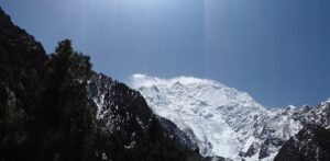
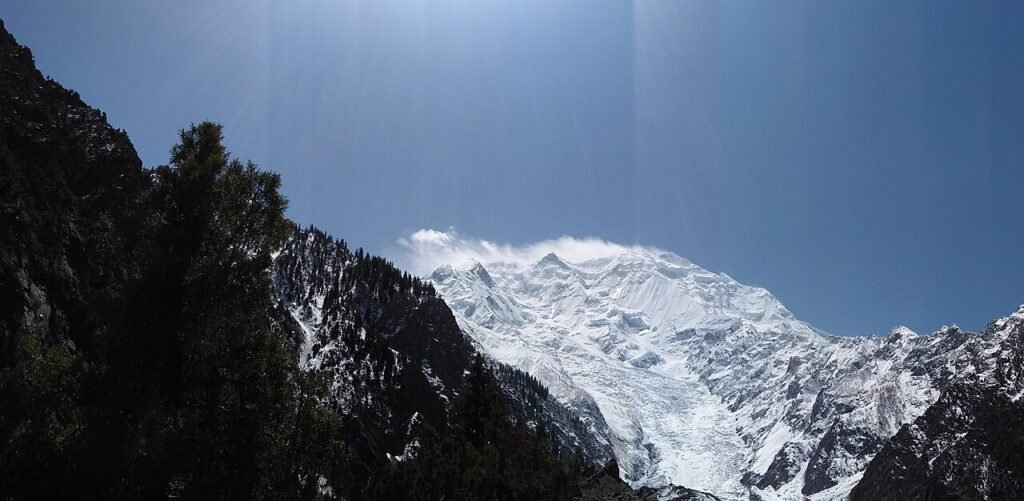
There is a particular moment on this trek, about an hour above Hapakun, when the trail stops being a walk and starts being a viewpoint. The trees thin out, the valley drops away behind you, and the wall in front of you — Rakaposhi and Diran joined by a ridge of ice — simply fills the sky. I have stood at the foot of bigger, harder mountains, and I have rarely felt smaller, or happier about it.
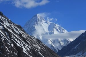
That is the promise of the Rakaposhi base camp trek, and it is a modest one in the best sense: no expedition logistics, no 4,000-metre-plus suffering, no two-week commitment. From the village of Minapin in Nagar district, a good trail climbs beside the Minapin Glacier to the meadows of Hapakun and on to Tagaphari, the Rakaposhi base camp, in two walking days up and one day down. It is the Karakoram at its most generous — a 7,788-metre giant, close enough to feel, on a trail a fit beginner can finish.
Short Answer
The Rakaposhi base camp trek runs from Minapin village in Nagar district to Tagaphari (Rakaposhi base camp, ~3,500 m) in 2 days up and 1 day down. Day 1 climbs ~9 km to Hapakun camp (~2,900 m) in 4–5 hours; Day 2 covers a shorter but much steeper ~4–5 km to Tagaphari in 3–4 hours; Day 3 descends all the way back to Minapin in 5–6 hours. Difficulty is moderate — the only genuinely hard section is the steep Hapakun-to-Tagaphari climb. Best months are June to September, with May and October as good shoulder options. A local guide is not mandatory on the main trail but is strongly recommended, and is essential if you extend to Diran base camp across the glacier.
Where This Trek Sits (and Where It Doesn’t)
First, the geography, because half the internet gets it wrong. Minapin is in Nagar district, on the north bank of the Hunza River, reached by a short detour off the Karakoram Highway roughly an hour to an hour and a half’s drive from Gilgit. The trek looks across at Hunza — from the ridges above Tagaphari you can see the Hunza Valley and its peaks spread out below — but you are walking in Nagar the whole time. Tour operators who file this trek under “Hunza” are selling the view, not the location.
That distinction matters for planning too. Your base is Minapin, not Karimabad. You sleep in Minapin the night before, hire your guide and porter there, and return there. If you want the full Nagar picture before you go, our things to do in Nagar Valley guide covers the valley this trek belongs to.
The Route, Day by Day
| Day | Section | Distance | Altitude | Walking time | Character |
|---|---|---|---|---|---|
| 0 | Arrive Minapin from Gilgit (KKH) | ~1–1.5 hrs’ drive | ~2,000 m | — | Village, guesthouses, hire guide/porter |
| 1 | Minapin → Hapakun camp | ~9 km | ~2,000 → ~2,900 m | 4–5 hrs | Orchards, pine forest, waterfall, dam |
| 2 | Hapakun → Tagaphari (Rakaposhi base camp) | ~4–5 km | ~2,900 → ~3,500 m | 3–4 hrs | Steep, alpine meadows, glacier viewpoint |
| 3 | Tagaphari → Minapin (descent) | ~13–14 km | ~3,500 → ~2,000 m | 5–6 hrs | Downhill all the way; knees will notice |
| Optional | Tagaphari → Diran base camp | ~3–4 hrs each way | ~3,700 m | Full day | Kacheli Glacier crossing — guide essential |
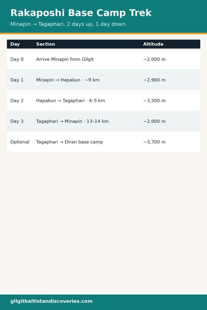
Altitudes and distances are the consensus of GPS tracks and operator itineraries, and they disagree at the margins: Minapin is quoted anywhere from ~2,000 m (GPS tracks) to 2,200 m (some operators), and Tagaphari from 3,400 m to 3,550 m. I have used ~2,000 m and ~3,500 m — the figures most sources converge on — and the honest point is that the gain is what your legs feel: roughly 1,500 m of ascent spread over two days.
Day 0: Minapin, the village that runs the trek
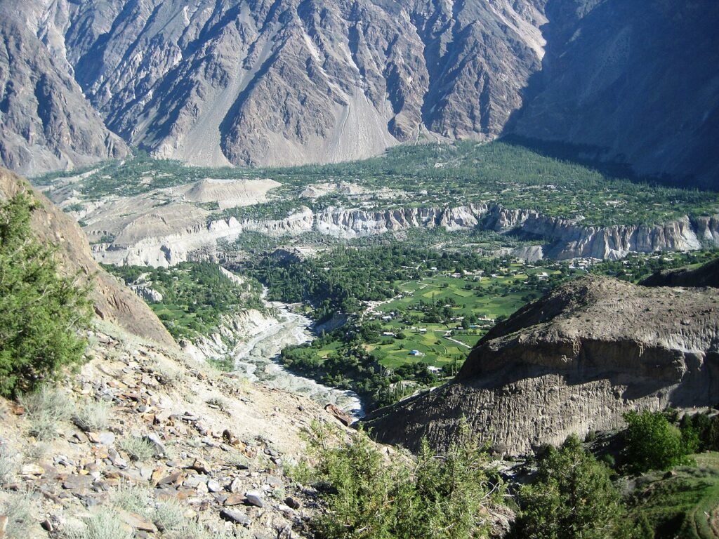
Minapin is a small, terraced village of apricot and walnut orchards with a handful of guesthouses — the Diran Guest House and the well-regarded Hotel Osho Thang are the names that come up most. Arrive the afternoon before, sleep here, and sort your logistics in person: this is where guides and porters are hired, and where you will hear the current trail conditions from people who walked them yesterday. One recent trip report paid a porter PKR 10,000 for the whole trek carrying 50 kg; treat that as a ballpark to negotiate from, not a fixed tariff.
Day 1: Minapin to Hapakun — the gentle day
The first stretch is almost suspiciously easy: a wide, jeep-built track climbs through orchards and pine forest, passing a small dam and a waterfall within the first half hour. GPS tracks put Minapin-to-Hapakun at about 8.8 km with roughly 935 m of ascent — a steady 4–5 hours at a normal walking pace with breaks.
Hapakun itself is a proper campsite, not a wilderness bivouac: three private campsites run by local families, with kitchens, toilets and pre-pitched tents. Shepherd families spend the summer here with their livestock, and the camp kitchens serve simple, excellent food — chapshuro, dal, rice — for roughly $15 a day including tent or sleeping-bag rental, according to one detailed recent guide. If you are a beginner, Hapakun is your friend: it splits the climb exactly where it should be split, and the evening view over the valley is already superb.
Day 2: Hapakun to Tagaphari — the steep day
This is the day the trek earns its “moderate” grade. The distance is short — only 4–5 km — but the trail climbs steeply through the greenest section of the route, and it takes 3–4 hours. Start early: the sun at this altitude is punishing from surprisingly early in the morning, and the afternoon cloud that builds over the ice wall can hide the very view you came for.
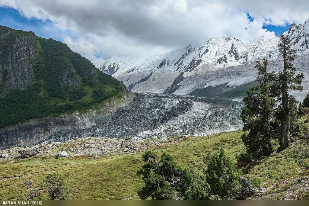
Just before Tagaphari you reach the glacier viewpoint, where the Minapin Glacier lies some 300 m below and Rakaposhi stands in full glory on your right, the jagged ridge running from it into Diran on your left. It is windy and cold here — the topography funnels wind through the gap — so put a layer on even if you were sweating ten minutes earlier. Then the trail turns right into the flat meadows of Tagaphari itself.
Tagaphari is one of the great campsites of the Karakoram: a broad, grassy bowl directly beneath the ice wall, with Rakaposhi (7,788 m) and Diran (7,266 m) visible simultaneously. There is even a flat area large enough for cricket that locals call the highest cricket ground in Gilgit-Baltistan, used when shepherd communities gather in summer. Spend the afternoon climbing one of the small ridges above camp for the 360-degree panorama — across to Hunza, along the ridge to Diran, and up the glacier toward the high camps you will never need to reach.
Day 3: Down, and the optional Diran extension
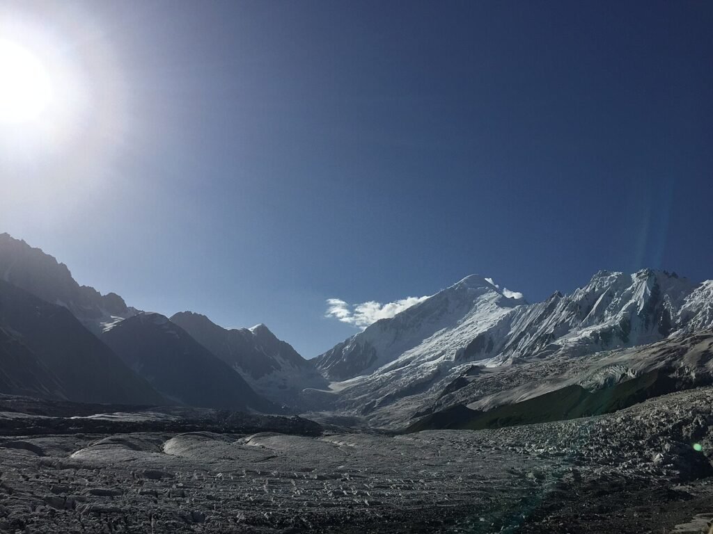
The descent to Minapin takes 5–6 hours and is harder on knees than the ascent was on lungs; trekking poles earn their weight here. If you have a fourth day and a guide, the extension across the Kacheli Glacier to Diran base camp (~3,700 m) is the classic add-on — 3–4 hours each way over crevassed ice. Do not attempt it unguided: the glacier is genuinely crevassed, and the “experienced trekkers only” warnings in every itinerary are not boilerplate.
How Hard Is It, Honestly?
Moderate — and I mean that precisely, against two benchmarks you may know from this site. It is harder than the Fairy Meadows hike (which is essentially a jeep ride plus a gentle 2–3 hour walk), and it is a different universe from the K2 base camp trek (12+ days, 5,000 m+, serious expedition logistics). Rakaposhi sits in the sweet spot between them: a real mountain trek that a fit person with no technical experience can complete, with one steep half-day that will test your legs and nothing that tests your nerve — except the optional glacier crossing, which is a separate decision.
Altitude deserves a straight answer too. At ~3,500 m, Tagaphari is high enough that you may feel the altitude — a slight headache, breathlessness on the steep sections, poorer sleep — but it is well below the zone where acute mountain sickness becomes a serious risk for most people. The two-day ascent profile is itself good acclimatisation: you sleep at ~2,900 m before pushing to 3,500 m. If you have a heart or lung condition, or you have suffered badly at altitude before, talk to a doctor first; everyone else should simply walk slowly on Day 2 and drink more water than feels necessary.
When to Go
| Month | Trail | Verdict |
|---|---|---|
| May | Open, some snow patches high up | Good — quiet, wildflowers starting |
| June–September | Clear, stable, warm days | Best — the reliable window |
| October | Cold nights, clear days | Good — late season, golden valley, fewer people |
| November–April | Snowbound, hazardous | Avoid — the trail is a winter route for locals only |
The consensus window is May to October, with June to September the safest bet. Autumn deserves a special mention: the valley below turns gold in October (see our autumn colour calendar for the Nagar peak window), and the trail is quieter — but nights at Tagaphari are properly cold by then, so bring a warmer bag than you think you need.
What It Costs
There are two ways to do this trek, and the price difference is large:
- Independent, hiring locally in Minapin: your main costs are Minapin guesthouse nights, Hapakun camp food and tent rental (~$15/day per one recent guide), and a guide/porter hired in the village (one recent report: PKR 10,000 for a porter for the whole trek; guides cost more — agree the price in Minapin before you start, in writing if possible). A realistic independent budget for the 3-day trek, excluding travel to Minapin, is roughly $100–$200 per person.
- All-inclusive tour package: operators quote roughly $400–$600 per person for Rakaposhi base camp packages, and multi-day Gilgit–Hunza tours including the trek run higher (PKR 75,000–150,000 for 5-day by-air packages in some listings). These typically include transport, accommodation, guide, porter, meals and camping gear.
Whichever route you choose, confirm every price before you commit — Pakistani trek pricing moves with fuel, season and group size, and the figures above are ranges from recent listings, not quotes. Tips for guides and porters (around $5–8 per day is customary on organised treks) are extra, and worth paying generously: Minapin’s trekking economy is the village’s livelihood.
Where to Stay
- Minapin: Diran Guest House and Hotel Osho Thang are the established options; book ahead in July and August, when the village fills up.
- Hapakun: the three family-run campsites (kitchens, toilets, pre-pitched tents) — no booking system, just turn up, though your Minapin guesthouse can usually radio ahead.
- Tagaphari: your own tent, or a tent arranged through your guide. There is no permanent structure at base camp, and that is part of the point.
What to Pack for This Trek
This is a 3-day walk, not an expedition, so pack light and pack for the steep Day 2 and the cold Tagaphari night. The full system — layers, footwear, and the rest — is covered in our what to pack for northern Pakistan guide; for this trek specifically, three things matter most: sturdy, broken-in boots for the steep moraine sections (KEEN Targhee 3 is a solid mid-weight choice), trekking poles for the descent, and a sleeping bag rated below what you expect — Tagaphari nights are cold even in August. A power bank (Anker PowerCore) is worth it: there is no charging at Hapakun or Tagaphari. For poles and the rest of the kit, a tagged search for trekking poles will sort you out.
Safety Notes Worth Taking Seriously
- Glacier: the Kacheli Glacier crossing to Diran base camp is crevassed. Guide, rope, and experience — or don’t go.
- Weather: afternoon cloud and rain can arrive fast off the ice wall; carry a waterproof shell even on a blue-sky morning, and be off the exposed viewpoint section before afternoon storms build.
- Water: streams along the trail are generally drinkable after treatment; carry a filter or purification tablets rather than assuming.
- Trail confusion: the last few kilometres before Hapakun can be confusing where trails braid; shepherds on the route will point you right, and a guide removes the question entirely.
- Sun: at 3,500 m with snow and ice reflecting, sunburn and snow-blindness are real risks — sunscreen, lip balm, and proper sunglasses, not fashion shades.
Frequently Asked Questions
How many days does the Rakaposhi base camp trek take?
Two days up and one day down is the standard: Minapin to Hapakun on Day 1, Hapakun to Tagaphari on Day 2, and back to Minapin on Day 3. Fit trekkers sometimes do the ascent in a single long day, and adding the Diran base camp extension makes it 4 days. Tour packages of 5–11 days include travel to and from Gilgit or Islamabad.
How difficult is the Rakaposhi base camp trek?
Moderate. A fit beginner can complete it: the trail is well-marked, there is no technical climbing on the main route, and the altitude (~3,500 m) is manageable with the two-day ascent. The hardest part is the steep Hapakun-to-Tagaphari section. The optional Diran glacier crossing is a separate, harder undertaking requiring a guide.
What is the best month for the Rakaposhi base camp trek?
June to September is the most reliable window, with clear trails and stable weather. May and October are good shoulder months — quieter, with wildflowers in May and golden valley colours in October — but expect snow patches in May and cold nights in October.
Do I need a guide for the Rakaposhi base camp trek?
Not mandatory on the main Minapin–Hapakun–Tagaphari trail, which is well-marked and well-travelled in season — but recommended, especially for first-timers, for navigation on the braided sections, current conditions, and local logistics. A guide is essential for the Diran base camp glacier crossing.
How do I reach Minapin, the trek’s starting point?
Minapin is in Nagar district, a short detour off the Karakoram Highway roughly 1–1.5 hours’ drive from Gilgit. Most trekkers fly or drive to Gilgit, spend a night there or go straight on, and hire a car or jeep to Minapin. Arrive the afternoon before your trek to arrange guides, porters and accommodation.
Last Updated: October 2026
The Rakaposhi base camp trek is the rare Karakoram experience that asks almost nothing of you and gives back something enormous: a 7,788-metre wall, close enough to hear the ice move, reached on foot in two days from a village where the people who guide you also grow the apricots you eat for breakfast. Do it in June or September, start early on Day 2, and give yourself the fourth day for Diran if the weather holds — you will not regret the extra night under that wall.