Last updated: October 2026
There is a particular kind of silence that lives at 3,300 metres, in a meadow in the Diamer District of Gilgit-Baltistan, where the grass ends and the north face of an 8,126-metre mountain begins. Getting to that silence is not simple, and nobody should pretend otherwise. If you are searching for how to get to Fairy Meadows, you have probably already discovered that the journey is really three journeys wearing one name: a long highway, a notorious jeep track, and a climb on your own two feet.
I have come to think the difficulty is the point. Fairy Meadows — Joot, to the people who live beneath it — was named Märchenwiese, “fairy-tale meadow,” by German climbers in the 1930s who had walked much further than you will and still stopped, astonished, in this grass. This guide gives you the whole route honestly: the real distances, the real times, what the jeep actually costs in 2026, and where the brochures tend to go quiet.
Disclosure: This post contains a small number of affiliate links. If you buy through them, we earn a commission at no extra cost to you, which helps keep this site running.
The Short Answer
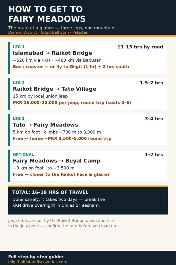
Fairy Meadows is reached in three legs. Leg one: travel the Karakoram Highway (KKH) from Islamabad to Raikot Bridge — about 11–13 hours by road, or fly to Gilgit and drive 2 hours south. Leg two: at Raikot Bridge, transfer to a local union jeep for the 15 km track up to Tato village — 1.5–2 hours, around PKR 16,000–20,000 per jeep for the round trip. Leg three: hike from Tato to Fairy Meadows — 5 km, roughly 3–4 hours on foot, climbing about 700 metres to the meadow at 3,300 m. Pushed hard, the whole journey is 16–19 hours of travel; done sanely, it takes two days, and you arrive at the meadow in time to watch Nanga Parbat catch the evening light.
The Route at a Glance
| Leg | Route | Distance | Time | Typical cost (2026) | Notes |
|---|---|---|---|---|---|
| 1 | Islamabad → Raikot Bridge (KKH) | ~520 km via KKH (~460 km via Babusar in season) | 11–13 hrs by road | Bus/coaster fare varies; private car much more | Or fly Islamabad → Gilgit (1 hr), then 2 hrs / ~80 km south by road |
| 2 | Raikot Bridge → Tato village (local jeep) | 15 km | 1.5–2 hrs | PKR 16,000–20,000 per jeep, round trip (seats 5–6) | Local union jeeps only; your own vehicle cannot go up |
| 3 | Tato → Fairy Meadows (on foot) | 5 km | 3–4 hrs (fit walkers 2–3) | Free; horse ~PKR 3,500–5,000 round trip; porter negotiable | Steady climb of ~700 m, from ~2,600 m to 3,300 m |
| Optional | Fairy Meadows → Beyal Camp | ~3 km | 1–2 hrs | Free; guide optional | Gentle extension to ~3,500 m, closer to the Raikot Face |
Fares are set by the local jeep union at Raikot Bridge, rise in the July peak, and change without notice — confirm the current rate at the bridge before you load up. Prices above reflect 2025–26 reported rates.
How Do You Get to Raikot Bridge?
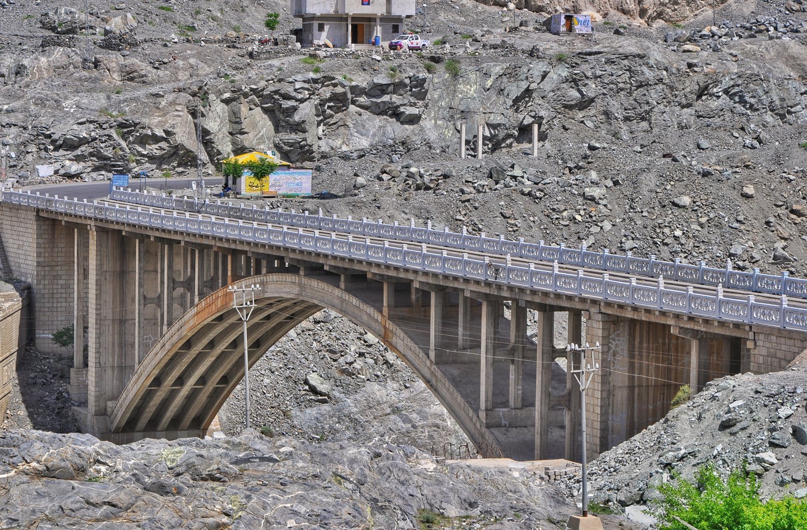
Everything begins at a bridge over the Indus. Raikot Bridge sits on the Karakoram Highway roughly 80 km south of Gilgit and about an hour’s drive north of Chilas, where the highway crosses the river beneath the immense northern flank of Nanga Parbat. There is no airport, no railway, no shortcut — the KKH is the way, and it deserves a day of your itinerary rather than a grudging few hours.
Most international visitors come from Islamabad. The full KKH drive runs about 11–13 hours in good conditions, usually broken overnight in Chilas or Besham. In summer only, the alternative route through the Kaghan Valley and over Babusar Pass is shorter and far prettier, but the pass is seasonal — snow closes it roughly from late autumn to early summer — so it is a bonus when open, never a plan to depend on. The faster option is the one-hour flight from Islamabad to Gilgit, weather permitting, followed by about 2 hours of driving south to Raikot Bridge. Those flights are famously weather-dependent, so build a buffer day into any tight schedule. We have laid out the Islamabad-to-the-north journey in full — bus companies, timings, and where to break the drive — in our guide to travelling from Islamabad to Gilgit-Baltistan.
How Much Does the Jeep from Raikot Bridge to Tato Cost?
Short version: budget PKR 16,000–20,000 for the jeep, round trip. That figure is consistent across 2025 and 2026 sources, including operator listings quoting about PKR 18,100 for summer 2025. A jeep seats 5–6 passengers, so a full jeep works out to roughly PKR 3,000–4,000 per person for the return journey — which is why solo travellers at the bridge instinctively start forming small groups in the car park. Sharing is not a hack; it is simply how the system works.
A few honest details the price lists skip. The fare is set by the local jeep union rather than negotiated in the usual bazaar sense — quotes can vary, especially in the July peak when demand outruns the number of jeeps, but aggressive haggling gets little traction. Your round-trip booking normally means the union brings you back down on your agreed day, so settle the return time before you climb in, and keep the driver’s phone number. You pay for the jeep whether two people ride in it or six — the best reason to arrive at Raikot in the morning, when seats fill quickly.
If walking the last leg is not for you, horses wait at Tato: expect roughly PKR 3,500 up and PKR 1,500 down — around PKR 3,500–5,000 for the round trip depending on season and negotiation. Porters for luggage are also arranged at Tato for a negotiated fee, typically a few thousand rupees per load. Agree the price before the animal or the man starts walking; mountain etiquette and common sense agree on this point.
What Is the Jeep Ride Actually Like?
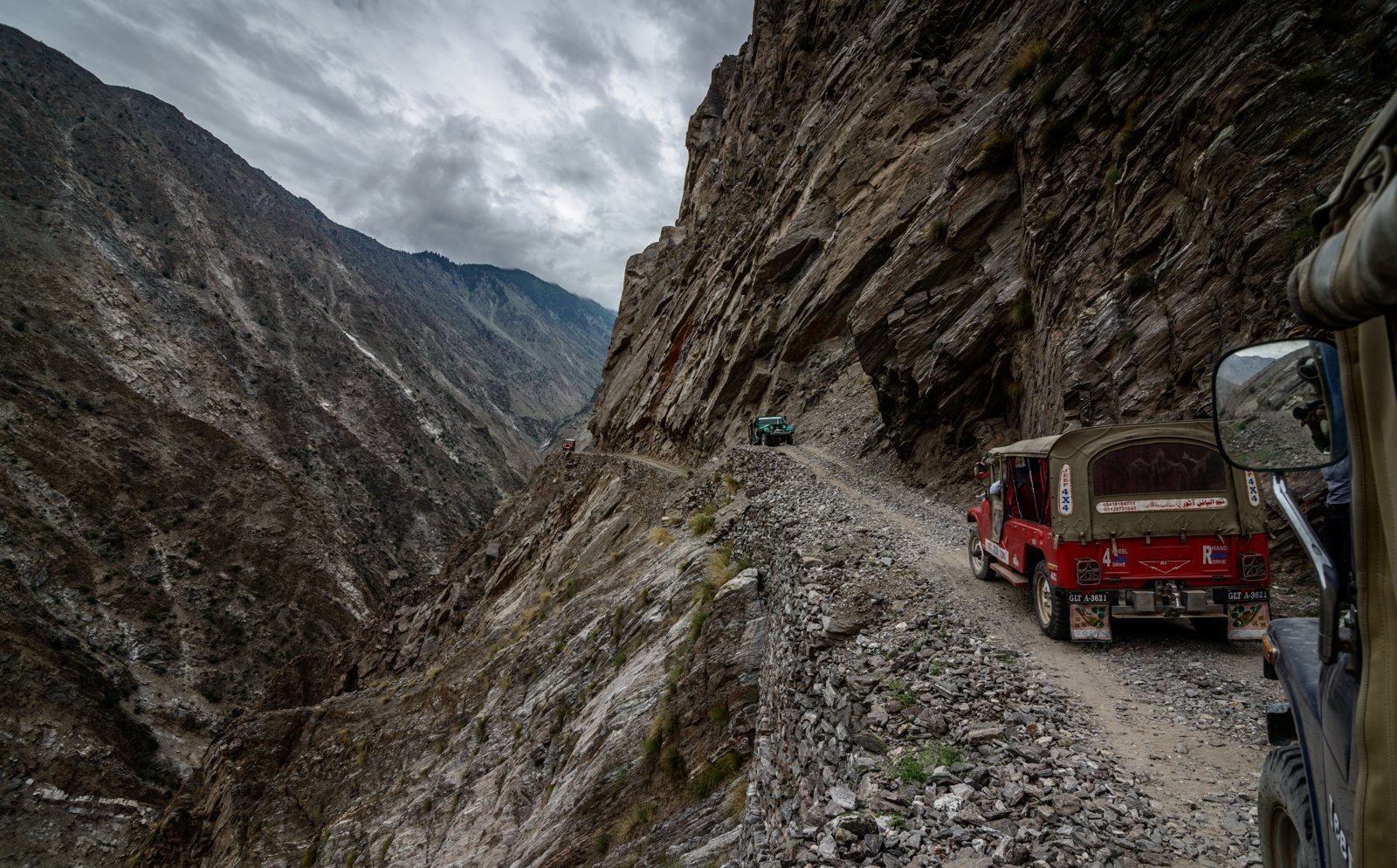
It is 15 km of gravel track cut into a mountainside above the Raikot gorge, and it takes 1.5–2 hours — which tells you everything about the average speed. The track is narrow, in places single-file with passing bays, with genuine exposure on the downhill side. Only local drivers, in the union’s jeeps, are permitted to drive it; private vehicles are turned back at Raikot Bridge, and after reading this far you should understand that as mercy rather than bureaucracy.
You will read that this road was declared the “second most dangerous in the world.” That claim is repeated everywhere, usually attributed to the WHO in 2013, and it is very hard to verify at source — treat it as folklore wrapped around a real truth. The real truth is simpler: the track is narrow, unpaved, and unforgiving of error, and it is driven daily, season after season, by men who know every bend of it the way you know your own street. Landslides can close it temporarily in the monsoon weeks of July and August; when that happens, you wait, because there is no other way up. Most people climb out at Tato slightly shaken and entirely unwilling to have missed it.
How Long Is the Hike from Tato — and How Hard Is It, Really?
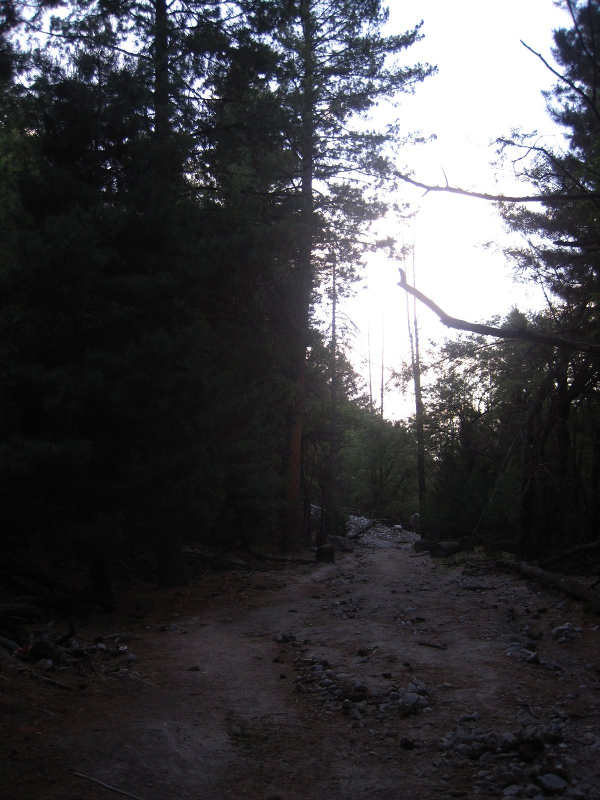
From Tato village, the road simply ends, and the last 5 km belong to your legs. The trail climbs steadily through pine forest from about 2,600 m to the meadow at 3,300 m — roughly 700 metres of ascent. Most walkers take 3–4 hours; the strong and acclimatised do it in 2–3; nobody sensible races it, because the altitude begins to make its argument somewhere around the halfway trees.
Difficulty honesty matters here, because this hike is described online as everything from “an easy stroll” to “brutal,” and both are misleading. It is a moderate mountain trail: clear, well-trodden, no technical sections, and no route-finding. What it has is gradient and altitude. If you have flown in from sea level and driven straight up the KKH, you will feel every one of those 700 metres. The fixes are unglamorous and effective: sleep a night at Raikot or Chilas first, start before the sun is on the slope, carry water, and let a horse carry your main bag while you walk with a daypack. The descent takes most people 2–3 hours and is harder on knees than hearts.
What to carry on your own back is a short list — water, a warm layer, sun protection, rain shell, snacks — because everything else can go on the horse. Our general packing list for travellers to Gilgit-Baltistan covers the full kit; the one upgrade worth making for this trail is footwear and poles, since 700 m of stony descent is where cheap shoes confess. A pair of proper trekking poles and broken-in hiking boots will repay you on the way down alone. And if Fairy Meadows is only the warm-up act for a bigger Karakoram objective, our K2 Base Camp trek packing list covers the full expedition-grade version of the same conversation.
When Is the Best Time to Go to Fairy Meadows?
The season is dictated by snow, not preference. The tourist season at Fairy Meadows runs roughly from April to the end of September, and the jeep track operates in the same window; outside it, snow closes the upper valley and the meadows empty. Within the season, the months have distinct characters:
- Late May to June — the meadows are at their greenest, wildflowers are out, and the crowds have not yet arrived. Nights are cold but the light is superb.
- July and August — the warmest weeks and the easiest trekking, but peak season: full jeeps, full huts, and the monsoon’s landslide risk on both the KKH and the jeep track.
- September — the connoisseur’s month. The crowds thin, the air clears after the monsoon, and Nanga Parbat shows itself most reliably. If you can choose, choose September.
Winter visits are effectively a mountaineering proposition rather than a holiday; the huts close, the track is impassable, and temperatures at 3,300 m are severe. Pin your plans to late spring through early autumn and the mountain will meet you halfway.
Where Do You Stay at Fairy Meadows?
You sleep in the meadow itself, in a scatter of family-run wooden huts and campsites — Raikot Serai is the best known — operated by families from Tato since camping began here in the 1990s. Expect a wooden cabin with a real bed and heavy blankets, meals cooked over wood fires (dal, rice, chapati, omelettes, endless tea), and prices in recent seasons of roughly PKR 2,000–6,000 per night depending on the hut and the month. Camping with your own tent costs less and buys you the stars, which at 3,300 m are a genuine second attraction.
Calibrate your expectations before you romanticise: there is no grid electricity (solar phone charging, sometimes), no hot showers as a rule, and no mobile signal — the last signal dies around Raikot Bridge. For most people this stops being a complaint by the second evening and starts being the reason they came. We have written separately, and bluntly, about what to expect — and what not to expect — from a Fairy Meadows trip: that piece manages the dream, this one manages the route. Book ahead for July and August; in May, June, and September you can usually arrive and choose.
Is Fairy Meadows Safe?
By the standards visitors actually mean — personal security — Fairy Meadows and the Diamer corridor are calm, well-travelled, and accustomed to foreign guests; you register at the Raikot checkpoint, and the valley’s tourism runs on one community’s reputation, which it guards carefully. The honest risks are physical, not human. The jeep track demands a registered local jeep. Weather at 3,300 m can turn within the hour, so check the forecast for the meadow itself, not for Gilgit. And the altitude is real: 3,300 m gives an unacclimatised arrival a headache and a sleepless night — one more reason the two-day approach beats the heroic single push.
The View That Earns Its Name
And then, at the top of the trail, the trees open.
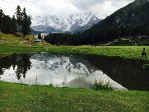
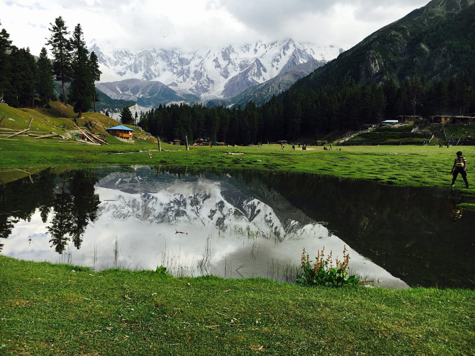
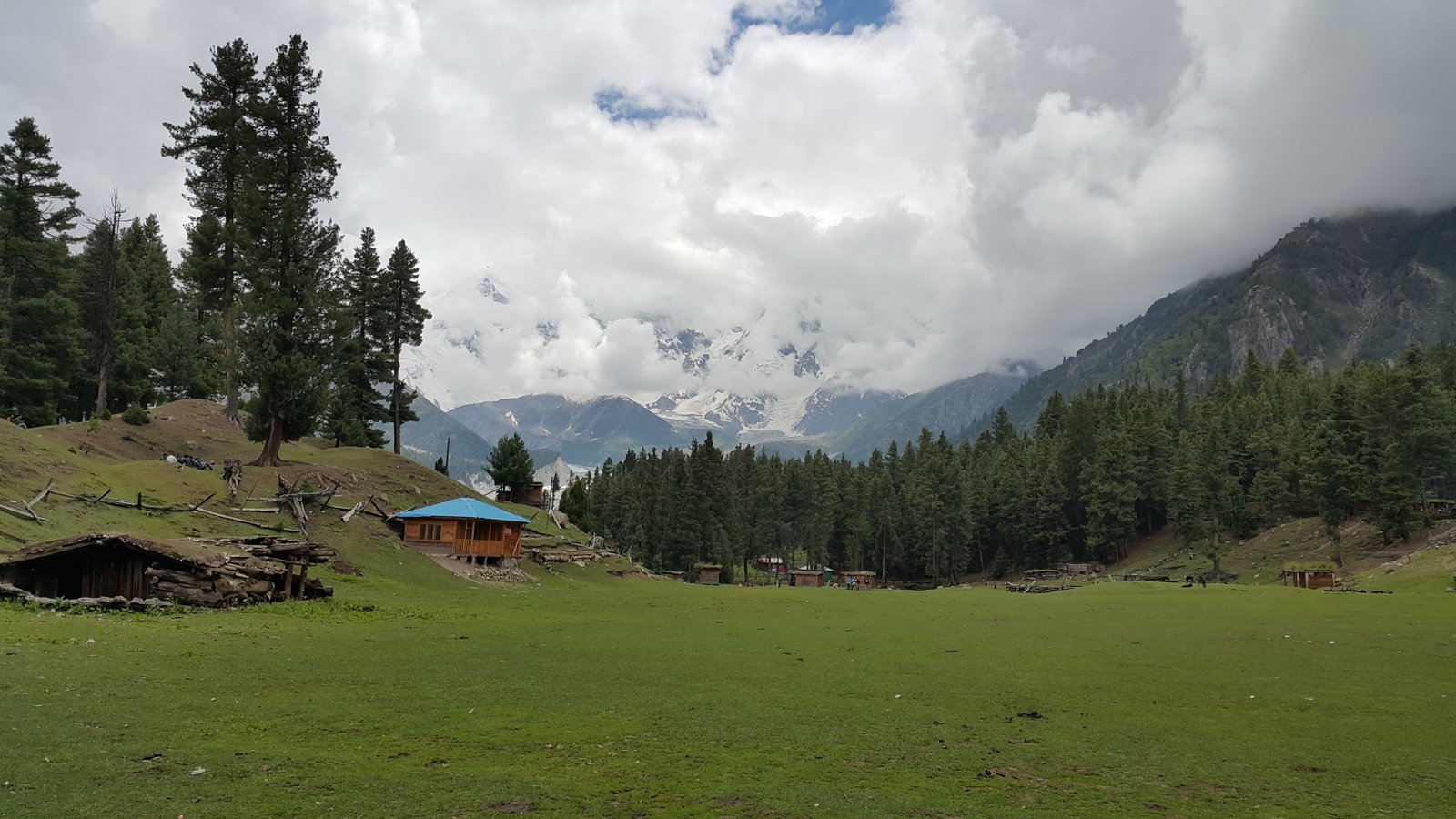
Fairy Meadows is a grassland cupped at the end of the Raikot Glacier, inside what is now Nanga Parbat National Park, and across it stands the Rakhiot Face of Nanga Parbat — 8,126 m, the ninth-highest mountain on Earth, the western anchor of the Himalaya. One precision worth having: the great summit that fills your window is mostly the North Peak (7,816 m); the true summit hides behind it and the Silver Saddle, and somehow that makes the view better rather than worse — the mountain keeps something back. At dawn the face goes rose, then gold; at night it simply refuses to stop being visible, a pale wall above the pines under the Milky Way.
Stay two nights, minimum, and on the second day walk the extension everyone underrates: Beyal Camp, an easy ~3 km beyond the meadows (1–2 hours, rising gently to about 3,500 m), where the forest thins, the Raikot Glacier comes close, and the face fills even more of the sky. Fit trekkers continue another 1.5 km to the viewpoint, or make a full day of the base camp area at about 3,967 m — but Beyal alone justifies the extra night. Every stage of Fairy Meadows, I have found, asks a little more of you than the brochure said, and pays back more than the brochure promised.
Fairy Meadows: Frequently Asked Questions
How much is the jeep from Raikot Bridge to Fairy Meadows?
The jeep goes to Tato village, not the meadows themselves — from Tato you hike. In 2025–26 the round trip costs about PKR 16,000–20,000 per jeep, shared between up to 5–6 passengers, so roughly PKR 3,000–4,000 per person in a full jeep. Fares are set by the local jeep union and rise in the July peak.
How long does it take to get to Fairy Meadows from Islamabad?
Count on two days done comfortably. The Karakoram Highway drive to Raikot Bridge takes 11–13 hours, usually split with a night in Chilas; then the jeep to Tato takes 1.5–2 hours and the hike up takes 3–4 hours. Pure travel time is 16–19 hours, so arrive the second afternoon.
How difficult is the trek from Tato to Fairy Meadows?
Moderate. The trail is 5 km with about 700 metres of steady climbing, from 2,600 m up to 3,300 m. It is a clear, non-technical path, but the gradient and altitude make it a real workout for unacclimatised walkers. Horses and porters at Tato can carry you or your bag if needed.
What is the best time to visit Fairy Meadows?
The season runs from about May to September, while snow keeps the jeep track open and the huts operating. July and August are warmest but busiest, with some monsoon landslide risk. September is arguably best: clear skies, reliable views of Nanga Parbat, thin crowds, and cool, bright days for the trek.
Can you drive your own car to Fairy Meadows?
No. Private vehicles stop at Raikot Bridge; the 15 km track to Tato is restricted to local union jeeps with experienced local drivers, and beyond Tato there is no road at all — the final 5 km to the meadows is a footpath. That restriction is a safety feature of the journey, not an inconvenience.