Short Answer
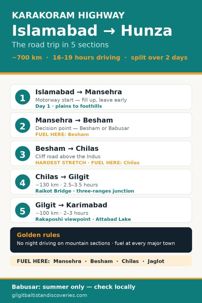
The Karakoram Highway (KKH, the N-35) from Islamabad to Hunza’s main town, Karimabad, is roughly 700 km and takes 16–19 hours of driving in normal conditions — a journey to split over two days, not one. The reliable all-year route runs via the Hazara Motorway to Mansehra, then Besham, Chilas and Gilgit before the final 100 km north to Hunza. In summer, the Naran–Babusar Pass route is shorter (about 530 km to Gilgit) and more scenic, but it closes with snow in winter, while the Besham route stays open year-round. Build in a buffer day: landslides, roadworks and weather can add hours with no warning.
Karakoram Highway at a glance
| Detail | What to know |
|---|---|
| Route | Islamabad → Hazara Motorway → Mansehra → Besham → Dasu → Chilas → Jaglot → Gilgit → Karimabad (Hunza) |
| Total distance (via Besham) | ~700 km to Karimabad |
| Total driving time (via Besham) | 16–19 hours by car; 18–22 hours by bus |
| Best split | Two days, overnight in Besham or Chilas |
| All-year route | Via Besham — open year-round, with winter snow delays possible |
| Summer alternative | Via Naran and Babusar Top (4,173 m) — roughly late May/June to October |
| Hardest stretch | Besham to Chilas — narrow, cliff-hugging, most exposed to rockfall |
| Fuel rule | Fill up at every major town: Mansehra, Besham, Chilas, Jaglot |
| Golden rule | No night driving on the mountain sections; start early, stop before sunset |
How long does each section take?
Distances and times below come from our own verified guide to travelling from Islamabad to Gilgit-Baltistan. Times are driving time in normal conditions — stops, checkpoints, roadworks and landslides all add to them.
| Section | Distance (approx.) | Driving time | What it is like |
|---|---|---|---|
| Islamabad → Chilas (via Besham) | ~470 km | 9–11 hours | Motorway and hills to Mansehra, then the Indus gorge; the long first day |
| Islamabad → Chilas (via Babusar, summer only) | ~400 km | 8–10 hours | Shorter and greener, over the 4,173 m pass; closed in winter |
| Chilas → Gilgit | ~130 km | 2.5–3.5 hours | Wider valley road; Raikot Bridge and the three-ranges junction on the way |
| Gilgit → Karimabad (Hunza) | ~100 km | 2–3 hours | Smooth, scenic KKH beside the Hunza River, past the Rakaposhi viewpoint |
| Islamabad → Karimabad (whole journey, via Besham) | ~700 km | 16–19 hours by car | Split over two days; buses take 18–22 hours |
Section 1: Islamabad to Mansehra — how do you get out of the plains?
The journey starts fast and easy: motorway north out of Islamabad, through Haripur and Abbottabad toward Mansehra. Use this easy stretch well: fill the tank, buy snacks and water, download offline maps, and leave early enough that the slow mountain sections still fall in daylight.
Mansehra is the decision point: the KKH continues north through Besham, while the summer alternative turns off toward Naran and Babusar Top. If Babusar is closed — all winter — take the Besham route. In summer, ask locally that morning rather than trusting a months-old blog post; the pass opens and closes with the snow, not the calendar.
Section 2: Mansehra to Besham — where does the mountain road begin?
Past Mansehra the road narrows and the hills close in. Abbottabad and Mansehra are the last towns of the foothills; beyond them, the KKH follows the Indus and the driving demands more attention. Besham, on the Indus, is the classic first overnight stop and a key fuel point. It is a working highway town rather than a destination — eat, refuel, sleep, and leave early.
Section 3: Besham to Chilas — why is this the stretch to respect?
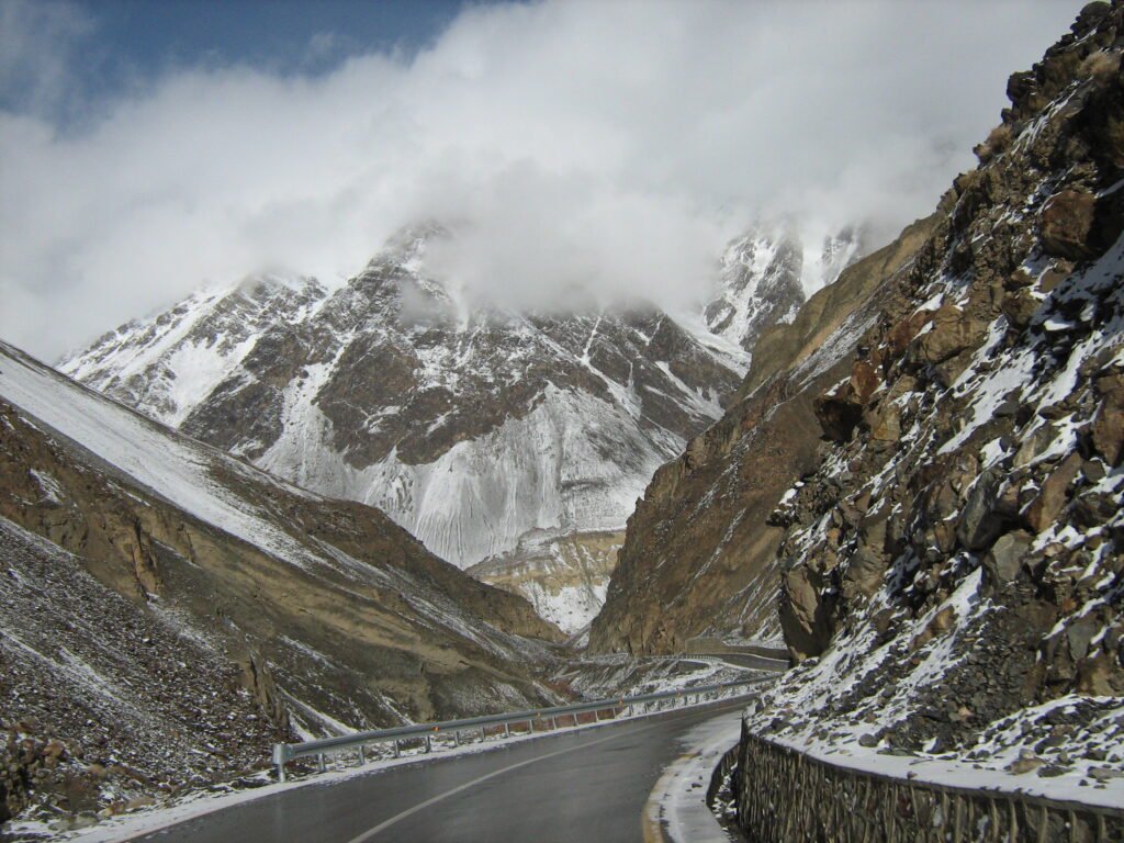
Besham to Chilas is the section every driver remembers. The road clings to cliffs above the Indus, in places narrow enough that two large vehicles pass with care, and it is the stretch most exposed to rockfall and landslides. Dasu and the Diamer-Basha dam works sit along this corridor, so expect construction traffic and occasional holds. Drive it in daylight, in dry weather if you can choose, and never in heavy rain if you can wait it out.
Chilas, at the far end, is the second classic overnight stop and another reliable fuel point, with ancient Buddhist rock carvings (petroglyphs) nearby. Sleep here if you started late, and start early again the next morning.
Section 4: Chilas to Gilgit — what changes after the gorge?
North of Chilas the valley opens, the road widens a little, and the drive relaxes — relatively. Two landmarks break the journey. At Raikot Bridge the road crosses the Indus; this is the turn-off for Fairy Meadows, reached by local jeep to Tato village and then a 5 km hike (see our Fairy Meadows hiking track guide). Near Jaglot you pass the famous junction of three great mountain ranges — the Himalaya, the Karakoram and the Hindu Kush — where the Indus and Gilgit rivers meet.
Gilgit itself is the crossroads of the whole region: refuel here, stock up, and decide whether to turn toward Skardu or push north to Hunza.
Section 5: Gilgit to Hunza — is the last leg really the easiest?
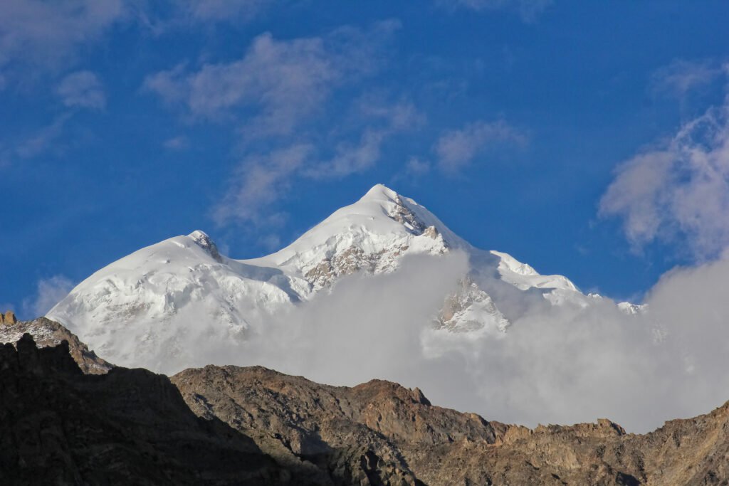
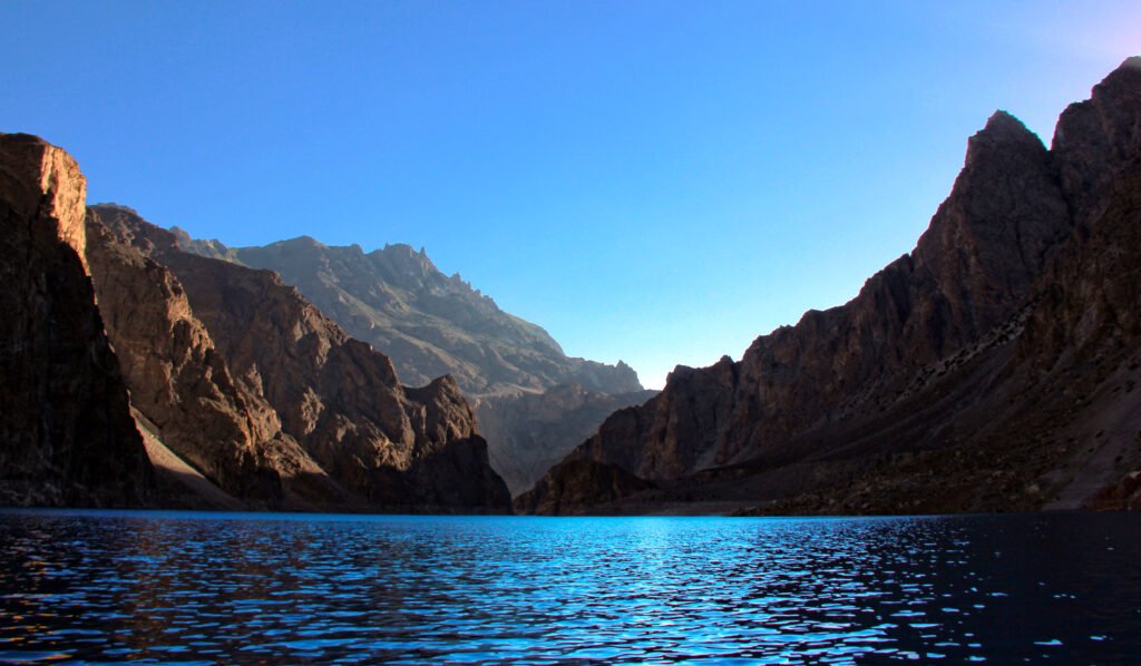
Yes — and that is part of its charm. The roughly 100 km from Gilgit to Karimabad takes two to three hours on a smooth, well-maintained road beside the Hunza River. The essential stop is the Rakaposhi viewpoint at Ghulmet, in Nagar District across the river from the Hunza side, where the 7,788 m peak rises almost 6,000 m above the road. After it comes Attabad Lake in Gojal, Upper Hunza — the long turquoise lake formed in January 2010 when a landslide blocked the Hunza River and drowned a stretch of the old highway, which has since been rebuilt on a higher alignment with tunnels.
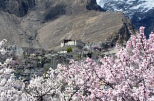
Karimabad, the main town of Hunza District, is the end of this guide: Baltit and Altit forts, the Duikar (Eagle’s Nest) sunset viewpoint, and the road onward to Passu and Khunjerab Pass. For what each season does to the valley, see our month-by-month guide to the best time to visit Hunza Valley.
When is the highway hardest?
| Period | What happens | What to do |
|---|---|---|
| July–August (monsoon) | Heavy rain south of the high valleys can trigger landslides that close KKH sections for hours or days | Travel with a buffer day; check road status daily; avoid night driving in rain |
| Late October–November | Babusar closes with the first heavy snow (in 2026 it shut on 11 October); high side roads begin closing | Route via Besham; confirm Babusar locally, never assume it |
| December–February (winter) | Snow delays on the KKH; Khunjerab and high passes snow-dependent; fewer services open | Use the Besham route only; carry warm layers; keep plans flexible |
| May–June | Babusar reopens once snow is cleared, usually late May or June; Fairy Meadows season begins | Best window for the Babusar alternative; confirm the pass opened before departing |
| September–October | Post-monsoon clarity, fewer crowds, autumn colour in Hunza from mid-October | The sweet spot for most drivers — but watch Babusar’s closing date |
Fuel, food and stops: how do you plan a KKH day?
- Fuel: Fill up at every major town — Mansehra, Besham, Chilas and Jaglot are the reliable points. Never pass a working pump on a low tank between towns, and do not rely on a single station being open. Fuel prices change with the market, so check the live pump price on your travel day rather than budgeting from an old figure.
- Food: Eat proper meals at Besham, Chilas and Gilgit. Between towns, roadside dhabas and tea stalls appear at intervals, but carry snacks and water for the Besham–Chilas stretch, where stops are thin and the driving is demanding.
- Cash: Carry enough Pakistani rupees in cash. Card payment cannot be assumed at highway stops, and ATMs thin out fast beyond the main towns.
- Documents: Pakistanis should carry their CNIC; foreign visitors should carry their passport with visa copies. There are multiple checkpoints along the KKH, and having documents ready speeds everything up.
- Connectivity: Mobile coverage is patchy in the gorges; SCOM has the widest footprint inside Gilgit-Baltistan. Download offline maps before you leave Islamabad, and tell someone your expected arrival time.
- Kit for the car: A well-serviced car with good ground clearance is the minimum; a 4×4 is more comfortable but not required for Gilgit or Hunza in summer. Carry a full-size spare, and a power bank for the long driving days — phones drain fast when they are hunting for signal in the gorges.
Babusar Pass: the seasonal alternative, honestly explained
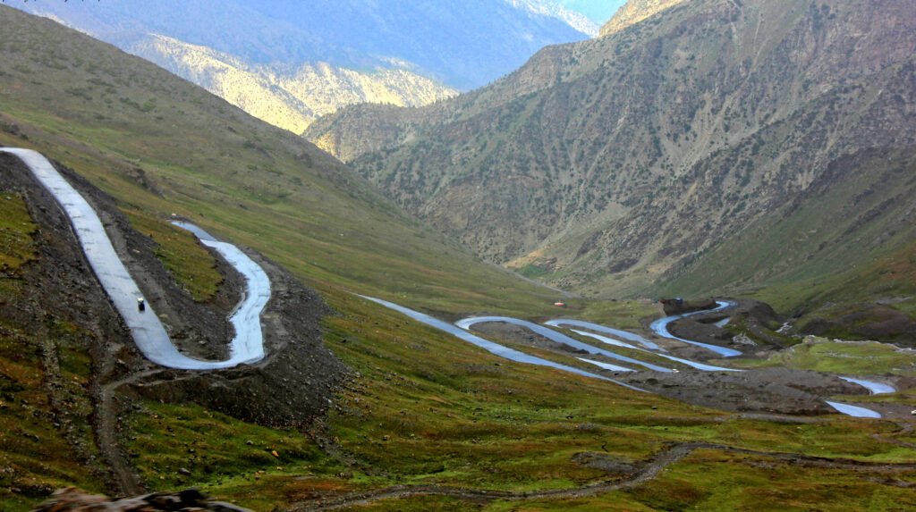
The Naran–Babusar route (Mansehra → Naran → Babusar Top at 4,173 m → Chilas) cuts roughly 70 km and two to three hours off the Islamabad–Gilgit journey, and in summer it is the prettier drive. But it is a seasonal road, not a second highway. It typically opens once the snow is cleared in late May or June and closes with the first heavy snow, usually in October or November — in 2026 it closed on 11 October. The descent from the top toward Chilas is steep, so brakes and tyres must be in good condition, and the route is a daytime-only crossing.
A realistic two-day plan
Day 1 — Islamabad to Chilas (via Besham), about 9–11 hours driving. Leave at first light. Breakfast stop around Mansehra, fuel and lunch at Besham, then the long gorge section in the afternoon light. Overnight in Chilas.
Day 2 — Chilas to Karimabad, about 5–6.5 hours driving. Early start, Raikot Bridge and the three-ranges junction as photo stops, fuel at Jaglot or Gilgit, the Rakaposhi viewpoint, Attabad Lake, and arrival in Karimabad by afternoon — with daylight to spare for the Eagle’s Nest sunset.
Travelling the Babusar way in summer, the shape is the same but the first day is shorter. Either way, keep one buffer day in the itinerary. The KKH rewards patience and punishes tight schedules.
Frequently Asked Questions
How long does the Islamabad to Hunza drive take?
Plan on 16–19 hours of driving in normal conditions, split over two days with a night in Besham or Chilas. Buses take 18–22 hours. Landslides, roadworks and weather can add hours, so keep a buffer day and never plan a tight connection on arrival day.
Is the Karakoram Highway open all year?
Yes, the Besham–Chilas–Gilgit route runs all year, but ‘open’ does not mean ‘easy’: winter brings snow delays and summer monsoon rain brings landslide closures. The Babusar alternative is different — it closes with snow, usually from late October until late May or June, so check locally before relying on it.
Which is better: Babusar or the Besham route?
In summer, Babusar is shorter and more scenic, saving roughly two to three hours to Gilgit, but it climbs to 4,173 metres with a steep descent to Chilas and closes in winter. The Besham route is longer and slower, especially between Besham and Chilas, yet it stays open year-round and suits winter travel.
Where should I stop for fuel and food?
Fill up at every major town — Islamabad, Mansehra, Besham, Chilas and Jaglot are the reliable fuel points — and never pass a working pump on a low tank in the mountains. Eat at Besham, Chilas and Gilgit, carry snacks and water for the Besham–Chilas stretch, and keep cash, as card payment cannot be assumed.
Is it safe to drive the Karakoram Highway at night?
No — avoid night driving on the mountain sections. Rockfall zones, unlit stretches, landslide debris and tired drivers make the Besham–Chilas leg dangerous after dark, and help is far away if something goes wrong. Start early, reach your overnight stop before sunset, and check the day’s road status each morning.
Last updated: 29 October 2026