Last updated: 4 November 2026
Short Answer
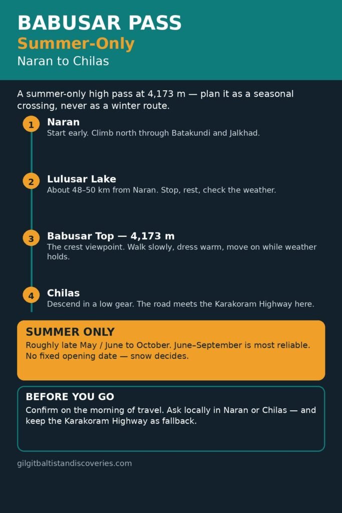
Babusar Pass, also called Babusar Top, is a summer-only mountain pass at about 4,173 metres (13,691 feet) that links the Kaghan Valley with Chilas in Gilgit-Baltistan. In season, the Naran–Babusar–Chilas road (the N-15) is the shorter, more scenic route from Naran and Kaghan into Gilgit-Baltistan. In winter, snow closes it, and travellers must use the all-year Karakoram Highway (KKH) via Besham instead. Never build a winter itinerary around Babusar, and always confirm the pass status on the morning of travel — even in summer, a single snowfall can change the plan.
Where is Babusar Pass, exactly?
Babusar Pass sits at the northern end of the Kaghan Valley, in Mansehra District, Khyber Pakhtunkhwa, and connects it with Chilas in Diamer District, Gilgit-Baltistan. That position matters for planning: the pass itself is not in Hunza or Nagar, and it is not on the Karakoram Highway. It is the high point of a separate road, the N-15, which meets the Karakoram Highway at Chilas. From Chilas, the KKH continues north along the Indus to Gilgit, and onward to Hunza and Nagar — two separate districts and valleys facing each other across the Hunza River, not one place.
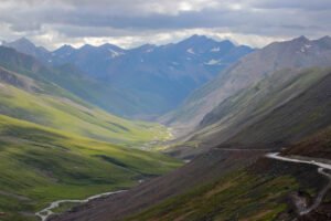
Travellers usually approach from the south, through Naran, or from the north, through Chilas. The Naran side climbs through green valley, meadows and lakes; the Chilas side drops steeply into hot, dry Diamer country.
When is Babusar Pass open?
Babusar Pass is open in summer only. Sources give slightly different windows, which is itself the point: the opening and closing dates are set by snow, not by a calendar. The usual window is roughly late May or June to October, with June to September the most reliable period for a crossing. Some sources describe the road as open from April to September, while others put the reliable crossing at June to September and warn that October is weather-dependent. Treat the broader range as the outer limit and the June-to-September window as the sensible planning window.
Do not treat any single date as a promise. Dawn reported on 3 November 2026 that heavy Kaghan snowfall had suspended traffic on the Mansehra–Naran–Jalkhad road, with the road cleared only as far as Naran and tourists temporarily barred from travelling beyond the town to Babusar Top. By November, the pass is not a route to rely on.
Practical rule: check the status on the morning you cross, ask locally in Naran or Chilas, and keep a fallback day. If Babusar is shut, use the KKH via Besham.
Which route should you take: Babusar or the Karakoram Highway?
The choice depends on the season, your direction, and how much time you have. In summer, Babusar is the scenic shortcut. Outside summer, there is no choice to make: use the KKH.
| Route | Rough distance, Islamabad to Gilgit | Season | Best for |
|---|---|---|---|
| Via Babusar Pass (Naran–Babusar–Chilas) | About 530 km | Summer only, roughly late May/June to October | The most scenic drive, Kaghan Valley, Lulusar Lake and Babusar Top in one journey |
| Via the Karakoram Highway (Besham–Dasu–Chilas) | About 600 km | All year | Reliability, winter travel, and any trip that cannot afford a snow closure |
Distances vary a little by measuring point, and driving times vary far more: the Islamabad-to-Gilgit journey via Babusar is commonly put at roughly 11–14 hours of driving in good conditions, and via the KKH at roughly 14–16 hours. Neither is a comfortable single-day drive for most travellers, and both deserve an overnight stop — Naran on the Babusar side, or Chilas or Besham on the KKH side.
What is the drive from Naran to Babusar Top like?
From Naran, the road climbs north through Batakundi and Jalkhad towards the crest. The distance from Naran to Babusar Top is about 65 km. Sources vary on the driving time, from about 1.5–2 hours without stops to 2–3 hours with stops, so allow 2–3 hours and enjoy the stops rather than racing the clock. The climb is substantial: Naran sits at roughly 2,400–2,500 metres, so the road gains roughly 1,700 metres to the 4,173-metre crest.
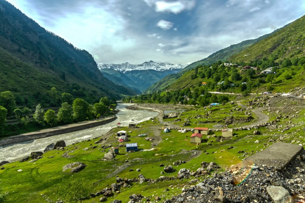
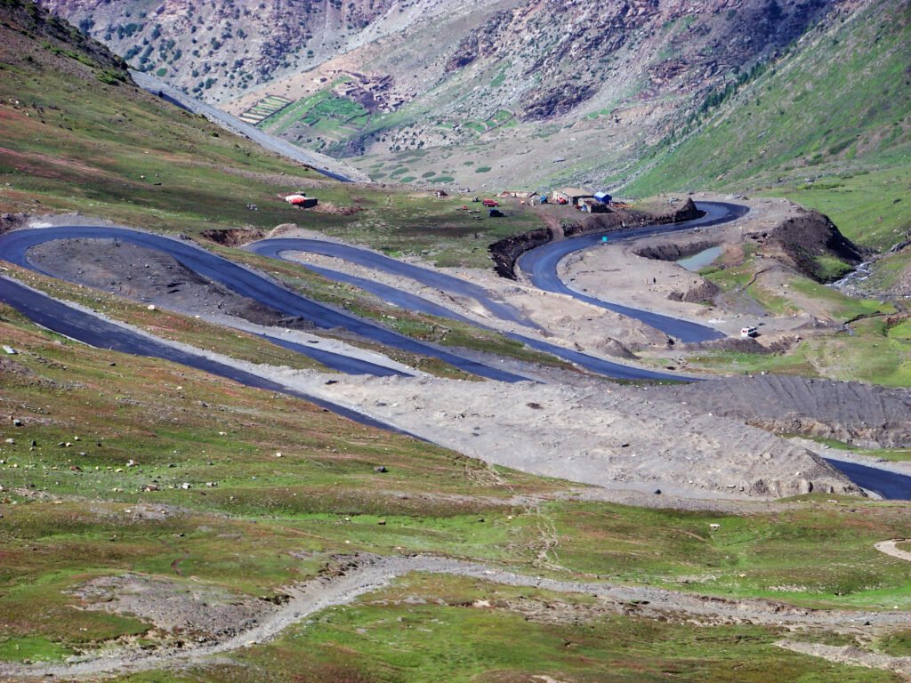
The road is paved, particularly on the Naran side, but that does not make it easy. It is steep, narrow in places, and full of abrupt direction changes. The descent on the Chilas side is long and demanding on brakes. This is a road where vehicle condition and driver patience matter more than speed. Use a low gear on descents rather than riding the brakes, give way where the road narrows, and do not attempt the crossing in poor visibility, heavy rain or snow.
Altitude deserves respect. At 4,173 metres, the air is noticeably thinner, and some travellers feel short of breath or tire quickly. Take the climb steadily, stop at Lulusar Lake on the way up, walk slowly at the top, and descend if symptoms worsen.
What will you see at Babusar Top?
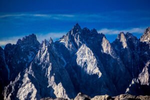
Babusar Top itself is a viewpoint, not a town: a high, open crest with panoramic views across the surrounding ranges. On a clear summer morning, the light is at its best and the crowds are thinner; afternoons can bring cloud, fog or sudden rain, so an early start from Naran is wise. Take warm clothing even in July and August — summer temperatures at the top stay cool, commonly reported at roughly 3–15°C, and wind makes it feel colder.
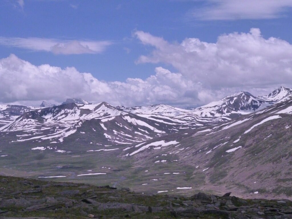
There is no need to linger for hours at the crest. Stop, take photographs, have a hot drink if stalls are open, and move on while the weather holds.
What about Lulusar Lake on the way?
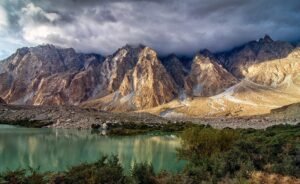
Lulusar Lake is the classic stop on the Naran side, and it is easy to see why. It sits directly on the Naran–Babusar road, about 48–50 km from Naran (sources vary slightly), at about 3,410 metres. It is the source of the Kunhar River, which runs the length of Kaghan Valley. The lake’s still, mountain-framed water makes it a natural break on the climb: stop here, stretch your legs, and let yourself acclimatise a little before the final climb to the crest.
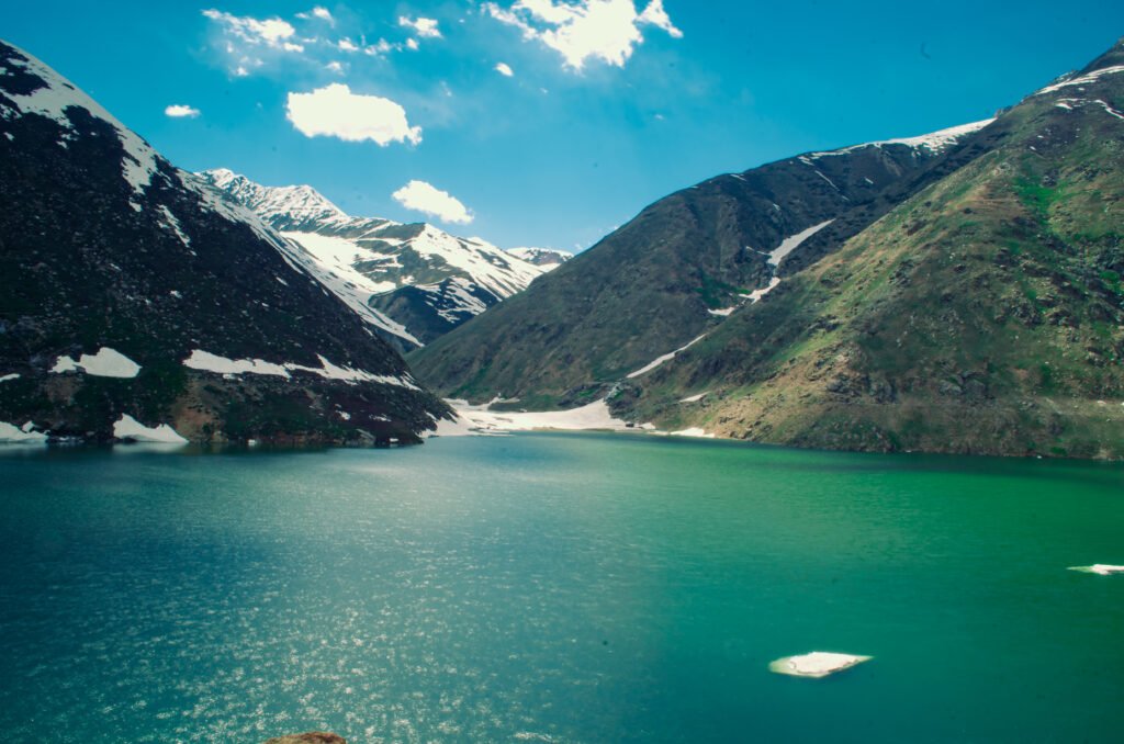
Lulusar Lake is roughly 15–20 km short of Babusar Top, depending on the source, so it works well as a decision point too. If the weather is closing in by the time you reach the lake, reconsider pushing on to the crest that day.
How should you drive Babusar Pass safely?
- Use a sound vehicle. Brakes, tyres, coolant and fuel matter enormously on a long, steep mountain road. Fill up before the climb.
- Drive in daylight only. Start early from Naran or Chilas, and plan to be off the high road well before dark. Fog, rain and tiredness all worsen after sunset.
- Go slowly on descents. Use engine braking in a low gear, especially on the long Chilas-side descent, and pull over to let brakes cool if you smell overheating.
- Expect narrow, winding sections. Give way to uphill traffic where the road narrows, sound the horn on blind bends where local practice expects it, and never overtake on a bend or crest.
- Watch the weather, not just the calendar. A summer crossing can still meet rain, cloud and cold at the top. If conditions deteriorate, turn back or wait it out in Naran or Chilas.
- Travel with a charged phone, water, warm layers and snacks. Mobile signal cannot be relied on at the crest, and there is no town at the top.
- Do not drive the pass if you are unwell, exhausted or unfamiliar with mountain driving. Hiring a local driver who knows the road is a sensible option, particularly for the Chilas-side descent.
How do you fit Babusar into a Gilgit-Baltistan trip?
In summer, Babusar works best as the scenic way in or out, not as a detour to be squeezed into a single day. A natural pattern is: Islamabad to Naran, Naran over Babusar to Chilas, then north on the KKH to Gilgit and Hunza — or the reverse on the way home, returning via the KKH through Besham so you see both routes. That loop gives you Kaghan Valley and the high pass in one direction and the Indus gorge and the KKH in the other.
If you are short of time, do not try to force Babusar into a tight schedule. A delayed opening, a landslide or an afternoon storm can cost a day.
For travellers heading beyond Gilgit — to Hunza, Nagar, Skardu or Fairy Meadows — Babusar is only the first leg. Plan the rest of the trip on KKH timings, and check each onward road separately.
Frequently asked questions
When is Babusar Pass open?
Babusar Pass is a summer-only route. Sources vary, but the usual window runs roughly from late May or June to October, with June to September the most reliable period. The exact opening and closing dates change with snow each year, so confirm the road status on the morning of travel and keep the Karakoram Highway as your fallback.
How high is Babusar Pass?
Babusar Top stands at about 4,173 metres (13,691 feet) above sea level, at the northern end of Kaghan Valley. That altitude is high enough for some travellers to feel short of breath, a headache, or tiredness, especially after a climb from lower valleys. Walk slowly at the top, drink water, rest, and descend if symptoms worsen.
Is Babusar Pass open in winter?
No. Babusar Pass closes with snow in winter and is not a winter route. Travellers in winter should use the Karakoram Highway via Besham, which runs all year. Even in late autumn, early snow can bar the road beyond Naran, as Dawn reported on 3 November 2026, so never plan a winter crossing.
How long does the drive from Naran to Babusar Top take?
The distance is about 65 km, and sources put the driving time at roughly 1.5–3 hours depending on stops, traffic and weather. Allow 2–3 hours, including a stop at Lulusar Lake, and start early so you cross in daylight. The descent to Chilas adds further driving time on a long, steep road.
Is the Babusar road suitable for an ordinary car?
In summer, a well-maintained ordinary car can cross, but the road is steep, narrow in places, and demanding on brakes. Check brakes, tyres and coolant before setting out, use a low gear on descents, and consider a local driver if you are unfamiliar with mountain roads. Do not attempt the pass in snow or poor visibility.