Last updated: 4 November 2026
Short Answer
The best photography spots in Gilgit-Baltistan are Duikar (Eagle’s Nest) above Karimabad for sunrise, the Passu Cones and Attabad Lake along the Karakoram Highway in Gojal, the Rakaposhi viewpoint at Ghulmet in Nagar, Fairy Meadows beneath Nanga Parbat, Deosai Plains and Sheosar Lake in summer, and the lakes and forts around Skardu, Shigar and Khaplu. Short on time? Base yourself in Hunza and Nagar.
Where are the best photography spots in Gilgit-Baltistan?
Gilgit-Baltistan is not one landscape but several, and that is why photographers return. In a single trip you can shoot a 7,000-metre panorama at dawn, a turquoise lake at midday, a centuries-old fort in warm evening light, and a wildflower plain under a huge sky. The table below gives the essential plan.
| Spot | Best light | Access |
|---|---|---|
| Duikar (Eagle’s Nest), Hunza | Sunrise | Short drive above Karimabad |
| Baltit and Altit Forts, Karimabad, Hunza | Morning for Altit; late afternoon for Baltit | On foot from Karimabad bazaar |
| Rakaposhi View Point, Ghulmet, Nagar | Early morning and late afternoon | Roadside stop on the Karakoram Highway |
| Attabad Lake, Gojal, Hunza | Early morning; late afternoon | On the Karakoram Highway; boats from lakeside villages |
| Passu Cones, Gojal, Hunza | Golden hour, morning or evening | Roadside views from the Karakoram Highway near Passu village |
| Khunjerab Pass | Late morning, when the road is fully open and the light is clear | Drive from Sost; border zone |
| Fairy Meadows, Diamer | Dawn for the Rakhiot Face of Nanga Parbat | Jeep to Tato, then a 3-4 hour walk |
| Deosai Plains and Sheosar Lake | Early morning and late afternoon; July and August for wildflowers | Jeep track from Skardu or Astore, summer only |
| Shangrila and Upper Kachura Lakes, Skardu | Early morning for reflections | Drive from Skardu; Upper Kachura by jeep track |
| Shigar Fort and Khaplu Palace, Baltistan | Soft morning and evening light | Drive from Skardu; Khaplu further east |
| Phander Lake, Ghizer | Dawn for mirror-still water | Drive through Ghizer Valley |
What should I photograph in Hunza and Nagar?
Start in Hunza District. Duikar, known as Eagle’s Nest, is the viewpoint village above Karimabad. On a clear dawn, five 7,000-metre peaks – Rakaposhi, Ultar, Golden Peak (Spantik), Ladyfinger and Diran – stand in a single panorama, widely regarded as the best sunrise in Hunza. Arrive before dawn, bring a tripod, and dress warmly.

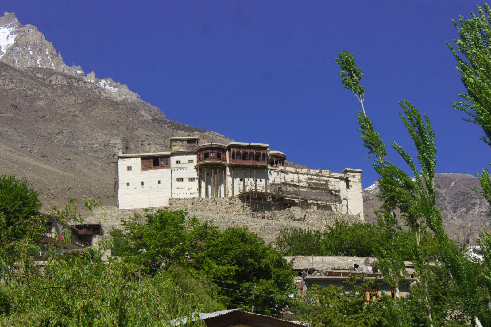
In Karimabad itself, Baltit Fort and Altit Fort give you history as well as landscape. Baltit Fort, over 700 years old and once the residence of the Mirs of Hunza, sits on a ridge above the town, and its rooftop looks across the valley to Rakaposhi (7,788 metres). Altit Fort is older still, at around 1,100 years, and perches on a cliff above the Hunza River. Morning light suits Altit’s stonework, late afternoon suits the Baltit rooftop, and the old village lanes between them photograph best in soft, low light.
Across the river in Nagar District – a separate district and valley from Hunza – the Rakaposhi View Point at Ghulmet on the Karakoram Highway gives the classic straight-on view of Rakaposhi’s great wall. It is a roadside stop, ideal for a golden-hour pause on the drive north.
What should I photograph along the Karakoram Highway in Gojal?
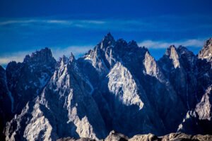
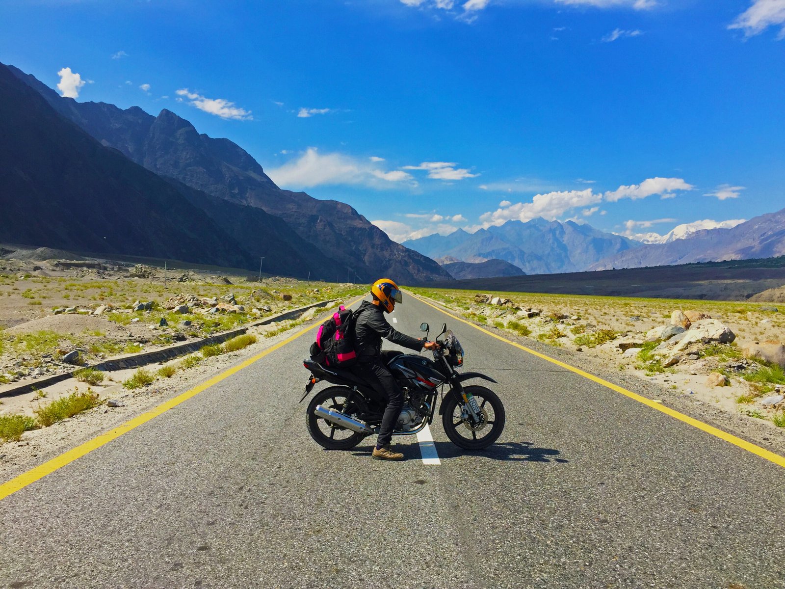
North of Karimabad, the Karakoram Highway runs through Gojal, Upper Hunza – the most photographed stretch of road in the region. Attabad Lake comes first. The lake did not exist before January 2010, when a landslide dammed the Hunza River; its intensely turquoise water, ringed by bare Karakoram walls, is now one of Pakistan’s most photographed places. Sources vary on its length, giving figures between about 13 and 21 kilometres. Shoot it in the early morning, when the water is still, or in late afternoon, when warm light strikes the cliffs; boats from the lakeside villages give a low, water-level angle that roadside shots cannot match.

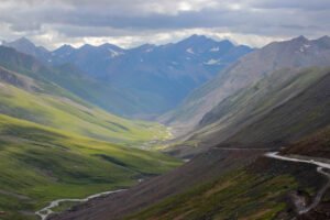
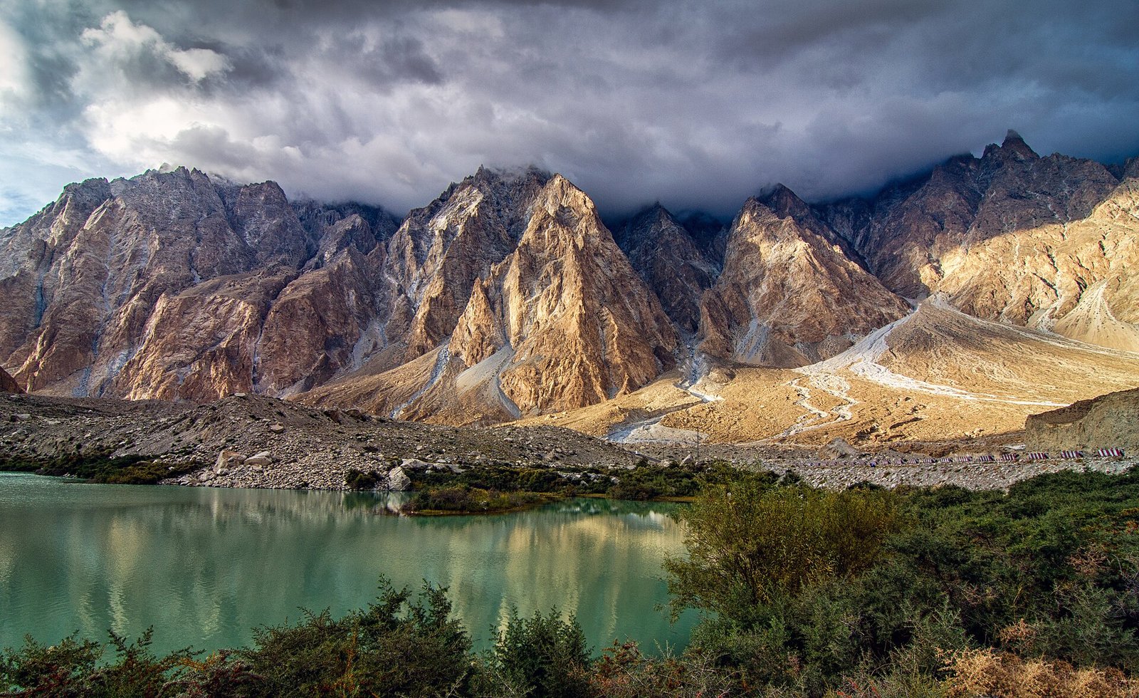
Further north, the Passu Cones – also called Passu Cathedral – rise as a row of jagged peaks above Passu village, among the most photographed mountain silhouettes in the country. Shoot them at golden hour, when the light rakes across the rock, and try both the roadside view and a short walk above the village for a higher angle. The nearby Passu Glacier adds foreground interest.
The highway ends, for most travellers, at Khunjerab Pass, at 4,693 metres on the border with China – described as the highest paved border crossing on Earth. The drive from Sost climbs past glaciers and ibex country into Khunjerab National Park, and the comfortable season is May to October. This is a border zone: photograph the landscape, not checkpoints or officials, and follow instructions on the ground.
What should I photograph in the high valleys and border country?
Fairy Meadows, in Diamer District, is the meadow beneath the Rakhiot Face of Nanga Parbat (8,126 metres), the world’s ninth-highest mountain. The meadow sits at about 3,300 metres, and the face fills the sky at dawn. Getting there is part of the story: a local 4×4 jeep ride from Raikot Bridge to Tato village, then a 3-4 hour walk through pine forest. The season runs May to September; walk on to Beyal Camp, about 3 kilometres further, for a closer, less crowded view of the face and glacier.

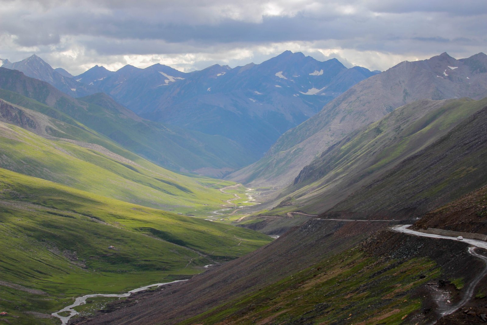
Deosai National Park, between Skardu and Astore, is a different wilderness altogether: a treeless alpine plateau averaging about 4,114 metres, often called the second-highest plateau on Earth. In July and August it becomes a wildflower meadow, home to marmots and Himalayan brown bears, and Sheosar Lake, at about 4,142 metres, mirrors the mountains in still water. The park is open only in the short summer, roughly June to September, reached by jeep track from Skardu or Astore. Take acclimatisation seriously, and give wildlife a wide berth.

What should I photograph in Skardu and Baltistan?
Skardu town is the springboard for Baltistan. Shangrila, also called Lower Kachura Lake, is the region’s postcard: a still lake fringed with willows and gardens, a short drive from town. Walk the shore rather than shooting only from the main gate, and arrive early, when the water holds a reflection. Upper Kachura Lake, a short jeep drive above Shangrila, is quieter and wilder, with a more natural shoreline.
East of Skardu, Shigar Valley and Khaplu offer the region’s finest historic architecture. Shigar Fort, also called Fong-Khar or “Palace on the Rock”, is a restored 17th-century fort above the Shigar River, with carved woodwork and views down the valley. Khaplu Palace, once home to the Raja of Khaplu, stands among apricot orchards, and the old lanes around it suit slow, observational photography. Soft morning and evening light flatters both buildings far better than harsh midday sun.
Finally, for a quieter mirror of water, consider Phander Lake in Ghizer District. Its turquoise valley is ringed with poplars, and at dawn the lake is often mirror-still, doubling the shore in the water. Ghizer is less visited than Hunza or Skardu, suiting photographers who prefer an empty shoreline.
When is the best light for photography in Gilgit-Baltistan?
As a rule, shoot at golden hour – the first and last light of the day – and rest your camera at midday, when the high-altitude sun is harsh and colours wash out. Dawn matters most at Duikar, Fairy Meadows and Phander Lake, where still air and low light create reflections and soft mountain colour; sunset matters most at Baltit Fort and the Passu Cones, where the last light warms the rock. Season matters too: blossom in late March and April, high valleys and Deosai from June to September, and autumn colour in Hunza, Nagar and Skardu from late September into early November. Never plan a shoot around an exact sunrise time quoted online; mountain weather changes quickly, and local conditions decide the light.
How do I photograph people and villages respectfully?
Gilgit-Baltistan’s villages are working communities, not open-air studios. Always ask before photographing people, explain what the photograph is for, and accept a refusal gracefully. Be especially careful when photographing women, children, and religious or private moments, and do not enter homes, courtyards or places of worship with a camera unless clearly invited. Do not photograph restricted areas, checkpoints or military installations, and never use a drone where it is not welcome or local rules forbid it – if unsure, ask locally first. Permission also makes better portraits: a short conversation beats a stolen shot.
What camera kit and preparation do I need for mountain photography?
Bring the camera you already know how to use. A wide lens suits valleys, lakes and fort interiors, while a longer lens suits peaks, glaciers and wildlife at a respectful distance. A lightweight tripod earns its weight at dawn and dusk, and spare batteries are essential, because cold drains them quickly at altitude. Protect gear from dust on jeep tracks and keep it dry near lakes and glaciers. Finally, back up your photographs every evening: a trip through Gilgit-Baltistan is hard to repeat, and a lost card is a lost journey.
Frequently asked questions
What is the single best photography spot in Gilgit-Baltistan?
There is no single winner, because the region rewards different subjects. For one classic mountain portrait, choose the Passu Cones from the Karakoram Highway at golden hour. For a sunrise panorama, Duikar above Karimabad is hard to beat. Pick the spot that matches the photograph you actually want to make.
When is the best time of year for photography in Gilgit-Baltistan?
Late spring to early autumn suits most photographers, with clear summer light for the high valleys and Deosai, and golden autumn colour in Hunza, Nagar and Skardu from late September into early November. Winter brings snow and short days, but road closures and cold limit access, so check conditions before travelling.
Do I need a permit to photograph in Gilgit-Baltistan?
There is no single published photography permit covering the region, so treat access as location-specific. Villages, viewpoints and lakes are generally open to visitors, while the Khunjerab border zone, checkpoints and military installations are restricted. When in doubt, ask locally before raising your camera.
What camera gear should I bring to Gilgit-Baltistan?
Bring the camera you know best, plus a wide lens for valleys and lakes and a longer lens for peaks and wildlife. A lightweight tripod helps at dawn and dusk, and spare batteries are essential because cold drains them quickly. Protect gear from dust on jeep tracks and keep it dry near lakes and glaciers.
Can I photograph local people in Gilgit-Baltistan?
Yes, but only with permission. Always ask first, explain what the photograph is for, and accept a refusal gracefully. Be especially careful when photographing women, children and religious or private moments. A short conversation and a smile usually matter more than the photograph itself, and often lead to better portraits.