Short Answer
Gojal is Upper Hunza — the Wakhi-speaking stretch of the Karakoram Highway (KKH) north of Attabad Lake — and Passu is its showpiece village. Come for the Passu Cones (Tupopdan, 6,106 m), a short walk to the Passu Glacier snout, Borith Lake above Hussaini village, the Hussaini Suspension Bridge, and the onward road through Sost to Khunjerab Pass (4,693 m). Allow two nights: one for Passu and Borith, one for the upper valley and the border road. The best window is May to October; November to April brings snow, closed high passes and thin services.
Where Gojal sits
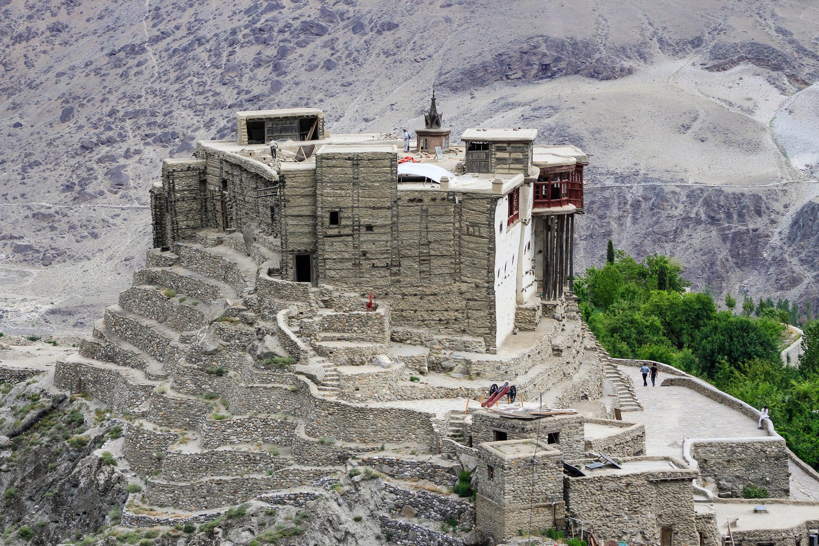
Gojal, also called Upper Hunza, runs from Attabad Lake in the south to Khunjerab Pass on the Pakistan–China border in the north. Its people are predominantly Wakhi-speaking Ismailis, and its villages — Gulmit (the old administrative centre), Ghulkin, Hussaini, Passu and Sost — sit along the Hunza River beneath some of the Karakoram’s most dramatic walls. Passu village lies about 147 km upriver from Gilgit on the KKH, and about 20 km from Gulmit.
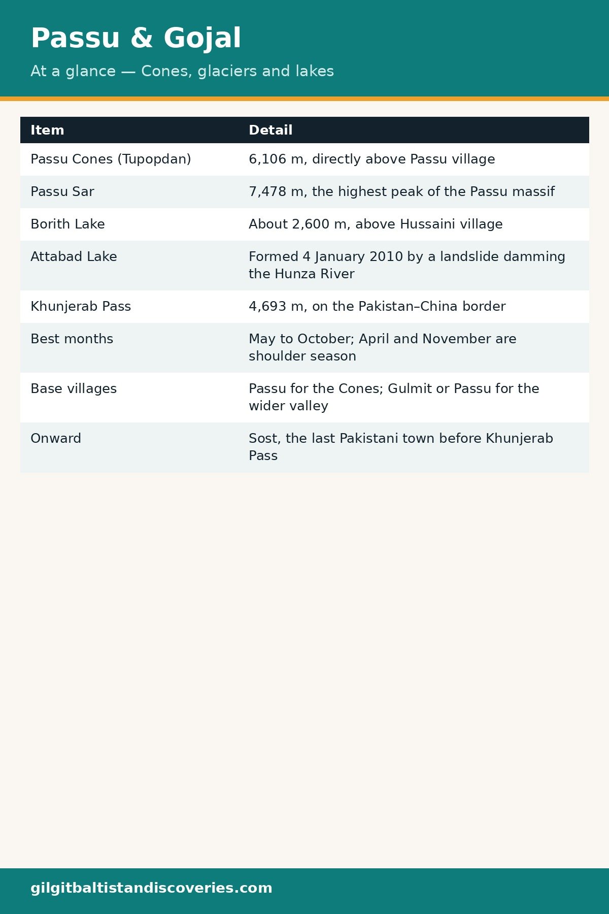
| Passu & Gojal at a glance | Detail |
|---|---|
| Passu Cones (Tupopdan) | 6,106 m, directly above Passu village |
| Passu Sar | 7,478 m, the highest peak of the Passu massif |
| Borith Lake | About 2,600 m, above Hussaini village |
| Attabad Lake | Formed 4 January 2010 by a landslide damming the Hunza River |
| Khunjerab Pass | 4,693 m, on the Pakistan–China border |
| Best months | May to October; April and November are shoulder season |
| Base villages | Passu for the Cones; Gulmit or Passu for the wider valley |
| Onward | Sost, the last Pakistani town before Khunjerab Pass |
The Passu Cones
What you are looking at
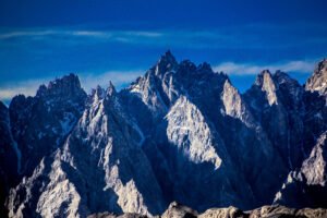
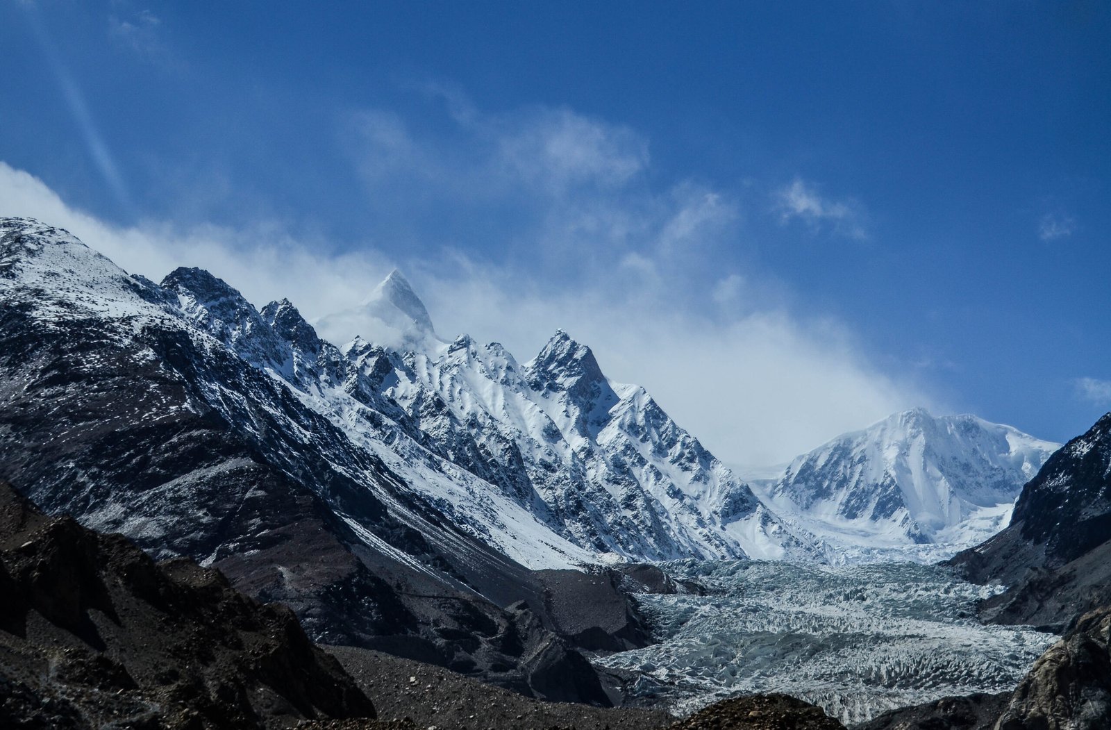
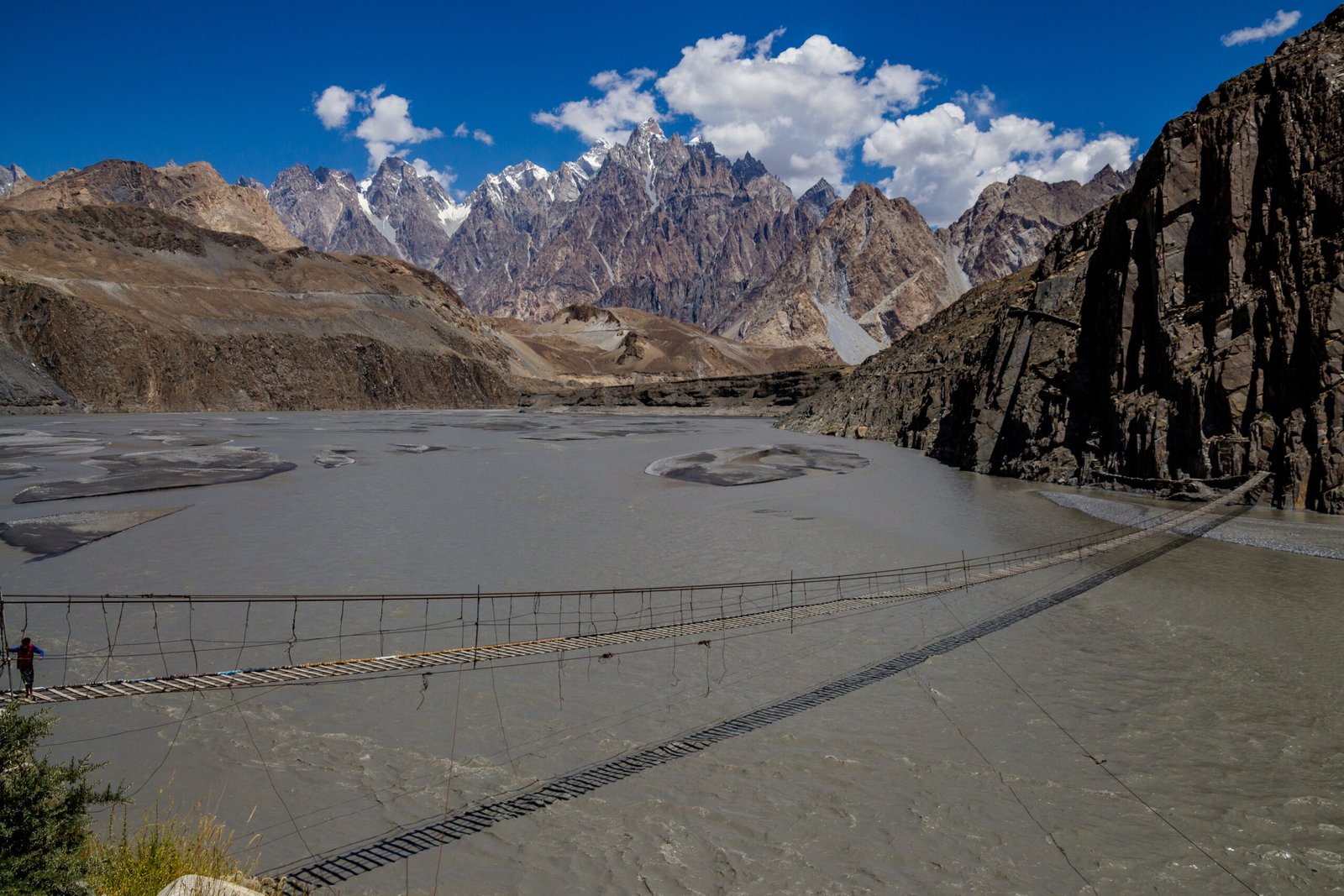
The Passu Cones — Tupopdan, also called the Passu Cathedral — are a wall of near-vertical granite spires rising directly above the KKH and Passu village. They are the most photographed skyline in Upper Hunza, and the classic view needs no walking at all: pull off the highway just south of Passu village. The finest light is at dawn, when the spires catch the first sun, and again at sunset from the Ghulkin side.
Passu Glacier walk
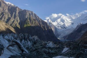
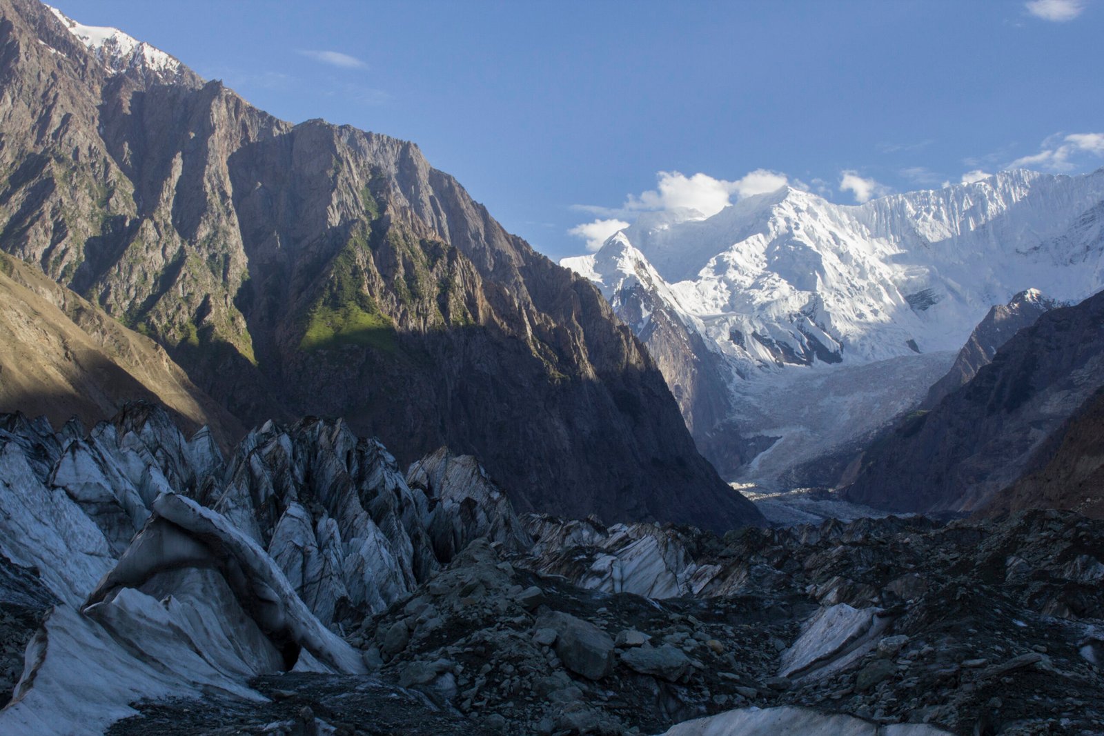
The Passu Glacier’s snout is about a 30-minute walk from Passu village — an easy, level outing that puts you face to face with crevassed ice beneath the Cones. Go with a local guide if you plan to step onto the ice itself; glacier surfaces shift, and the safe line changes with the season. The longer Batura Glacier, about 56 km long, runs to the north of Passu and is a multi-day undertaking, not a day walk.
Borith Lake and Hussaini
Borith Lake
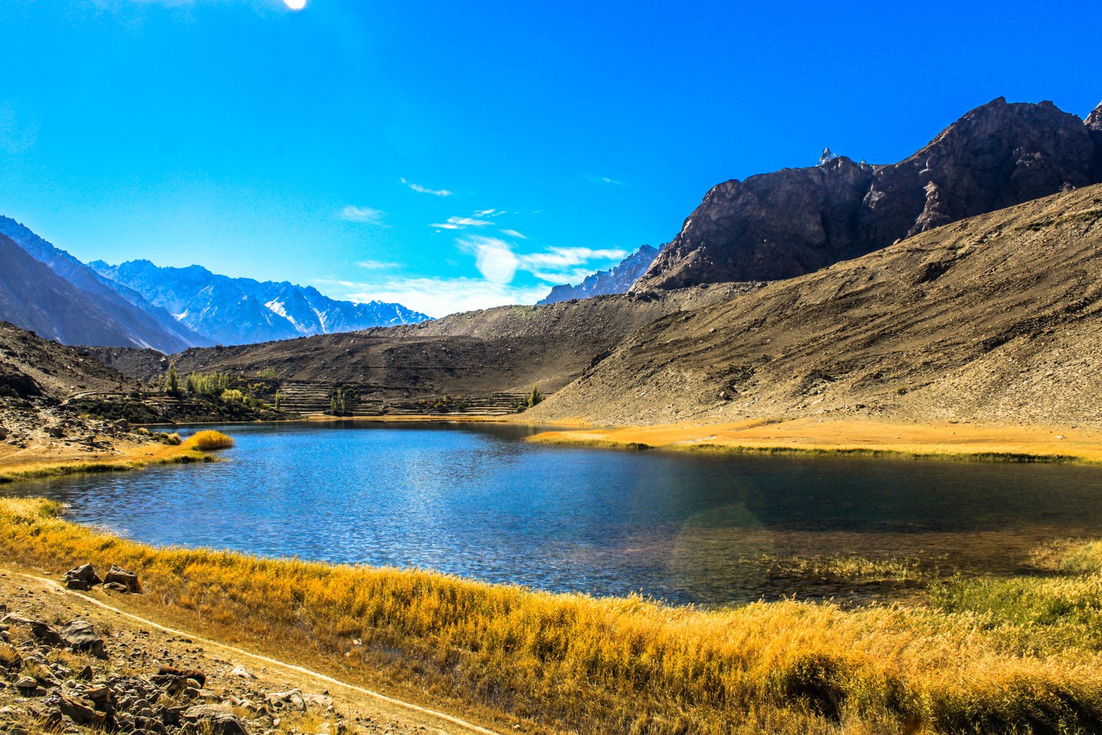
Borith Lake sits at about 2,600 m above Hussaini village, fed by meltwater from the Passu Glacier. Reach it by paved road from the KKH near Hussaini, then a short, moderately steep walk of roughly 30–40 minutes over moraine to the first viewpoint. The lake is saline, still and reflective on calm mornings, and it draws migratory birds in spring and autumn. Small tea stalls operate at the lakeside in season, and simple huts offer overnight stays; most visitors come for the day and sleep in Passu or Gulmit.
Hussaini Suspension Bridge
Near Hussaini village, the Hussaini Suspension Bridge crosses the Hunza River on a long span of cables and planks. It is a working village bridge, not a theme-park attraction: cross one at a time, hold the cables, and do not cross in high wind. It is one of the most photographed bridges in Pakistan precisely because it looks — and feels — as exposed as it is.
Attabad Lake, on the way in
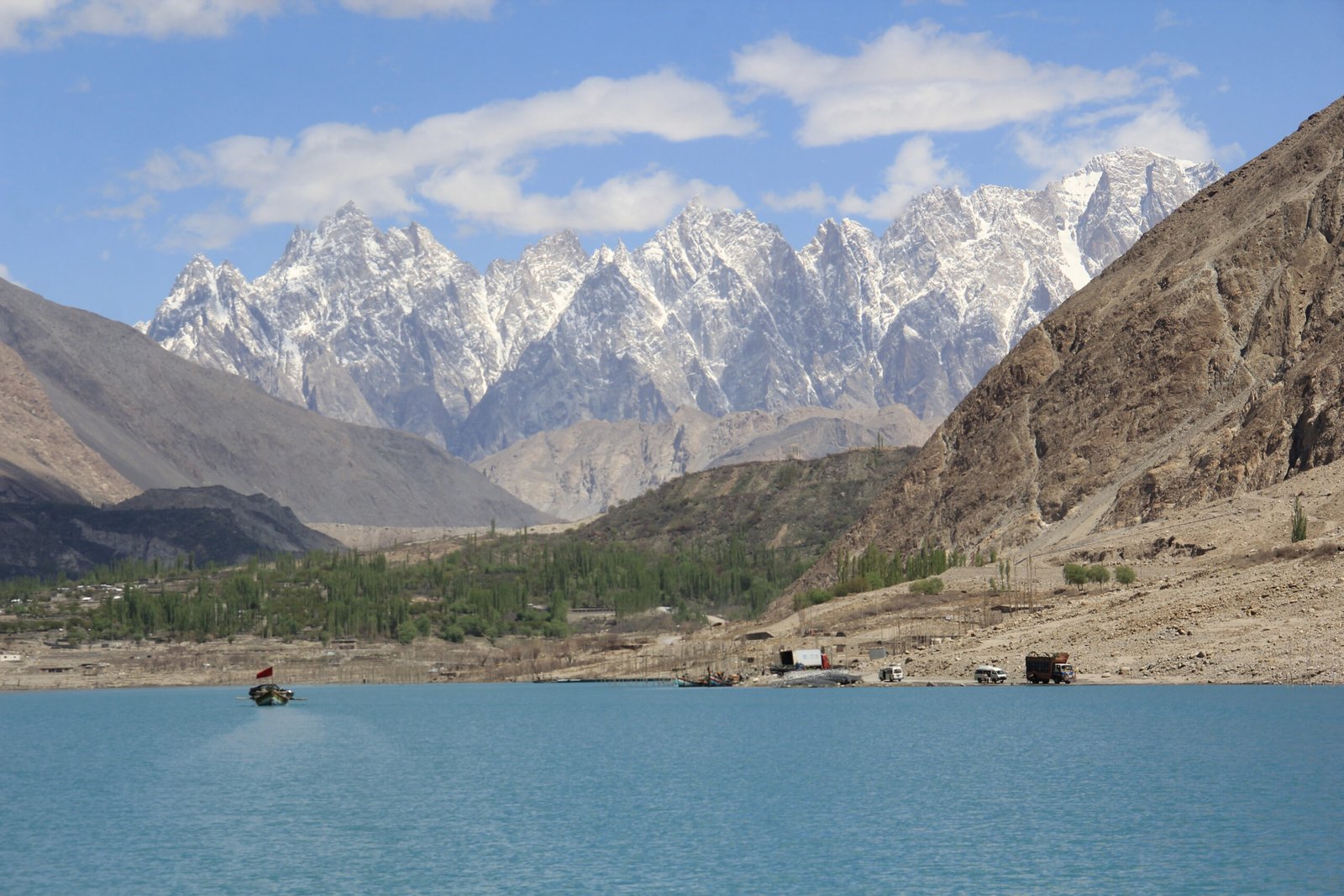
Every Gojal trip passes Attabad Lake, formed on 4 January 2010 when a landslide dammed the Hunza River and drowned a stretch of the KKH. The highway now runs through tunnels around the lake, and the lake itself is a boating and jet-ski centre in season. Do not confuse a social-media scare with reality: as reported in 2026, silt flats at the lake’s upper end are not the lake drying up, and the main boating area remains intact. Stop for a boat ride on the way up, not as a substitute for Gojal itself.
Sost and the Khunjerab road
Beyond Passu, the KKH continues through Sost — the last Pakistani town before the border — to Khunjerab Pass at 4,693 m. The pass road is a summer crossing: it is open roughly May to October and closed by snow in winter, and the border crossing itself runs on its own seasonal timetable, so check current status before driving up. At 4,693 m the air is thin; take the altitude seriously, walk slowly, and descend if a headache or nausea worsens. The site’s altitude advice applies in full: see What to Pack for Northern Pakistan.
Where to stay and eat
Passu has guesthouses and lodges with Cones views; Gulmit, a short drive south, has a wider choice including the old polo ground and a small museum. Book ahead in July and August. Food is simple valley cooking — chapshuro, dumplings, apricot-based dishes in season — and trout where available. Carry cash: ATMs are unreliable beyond Karimabad, and card payments are rare in Gojal villages.
Practical tips for Passu & Gojal
- Two nights, not one: Passu deserves a full day, and the Khunjerab road deserves another. Day-trippers from Karimabad see the Cones from a car window and miss Borith, the glacier walk and the bridge.
- Road reality: The KKH to Passu is paved and open year-round in principle, but winter snow, landslides and the Khunjerab closure all bite. Check conditions before the border run.
- Power and charging: Guesthouse power can be patchy. A power bank is worth its weight on long KKH days — the Anker PowerCore 10000 is the site’s tested pick.
- Combine it: Pair Gojal with Karimabad (see the companion Karimabad guide) and with the Best Time to Visit Hunza Valley guide for season timing.
- Visas and permits: Open valleys of Gojal need no special permit for most foreign visitors; the position is set out in the Pakistan Tourist Visa Guide.
Frequently Asked Questions
Where is Passu in Hunza?
Passu is a village in Gojal (Upper Hunza), Hunza District, on the Karakoram Highway about 147 km upriver from Gilgit and about 20 km from Gulmit, beneath the Passu Cones and the Passu Glacier.
What are the Passu Cones?
The Passu Cones, or Tupopdan, are a row of near-vertical granite spires rising to 6,106 m directly above Passu village. They are Upper Hunza’s most photographed skyline and are best seen from the highway pull-off south of the village.
When is the best time to visit Passu and Gojal?
May to October, when the KKH is fully open and the Khunjerab road is running. April and November are quieter shoulder months; winter brings snow, closed passes and very limited services.
How do I get to Borith Lake?
Drive the paved road from the KKH near Hussaini village, then walk roughly 30–40 minutes over moraine to the lake viewpoint. The walk needs grippy shoes but no technical gear; go early for calm reflections.
Is the Khunjerab Pass open all year?
No. The Khunjerab road is a summer crossing, open roughly May to October and closed by snow in winter, and the border crossing itself follows its own seasonal timetable — check current status before driving to Sost.
Last updated: 26 October 2026